
Search Results
Filter
Map Attributes
Longitude and Latitude
Remove constraint Map Attributes: Longitude and Latitude
Land Features
Mountain/Volcano
Remove constraint Land Features: Mountain/Volcano
Language
Spanish
Remove constraint Language: Spanish
Sea Routes
Maritime Route
Remove constraint Sea Routes: Maritime Route
Transport Hubs
Port
Remove constraint Transport Hubs: Port
2 Results found

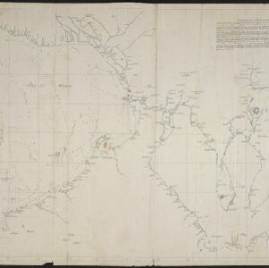
[Manuscript map of Manila Harbor and Bay Lake]
1810
Philippines
This early 19th century hand-drawn map of Manila Bay has detailed instructions in Spanish on how to enter the bay, and the port at Cavite. Bathymetry (water depth), the mouths of rivers, and landmark mountains are shown to aid navigation.
- Filter from 1810 to 1852
- [remove]Spanish2
- [remove]Longitude and Latitude2
- Scale1
- Written Note/Details1


