
Search Results


Map of the Island of Singapore and its dependencies
1898
Singapore
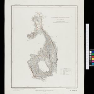
Map of Singapore Island, divided into Districts, including the surrounding islands and straits. The city centre, roads and forests are marked. MacRitchie Reservoir is at the centre of the island, with coconut plantations along the east coast.

A map of the Malay Peninsula
1898
Malaysia, Singapore, Thailand
Map of the Malay Peninsula showcasing the Straits Settlements in pink, the Federated Malay States in red, and Siamese states in yellow. A table of common words in English, Malay and Siamese is included. Only four of six sheets are available.

Karte des Mahakam-Flusses in Borneo: Nach den aufnahme der Niederländischen Expedition zur Durchquerung Borneo's, 1896-1897
1898
Indonesia, Malaysia
Map of the Mahakam River in Borneo, based on an expedition by the Dutch explorer Dr. Anton Nieuwenhuis in the late 19th century. An inset map shows the upper reaches of the river at twice the scale of the main map.

Kaart van 't noordwestelijke gedeelte der Residentie Ambon
1898
Indonesia
Map of the residency of Ambon in the Maluku Islands, divided by colour-coded administrative borders. There are inset maps the Banda Islands—including the nutmeg plantations and the town of Neira with its fort and hospital—and of Dutch New Guinea.


Burma and adjacent countries: With additions and corrections to boundaries and railways up to December, 1898
1898
Myanmar, Thailand
The regional and national borders of Burma and Siam are hand-coloured on this map. Provinces, districts and states within Burma are also highlighted, and itemised in a separate list.

Burma with parts of India, China and Siam
1888
Myanmar, Laos, Thailand
Map of Burma used as advertising by a clothing shop in Rangoon (Yangon, Myanmar). There is a calendar with each day marked with an historic event. The map is labelled with indigenous peoples (uppercase red text) and products of each area.


- Filter from 1478 to 1900
- Indonesia767
- Malaysia525
- Myanmar503
- Thailand485
- Singapore462
- Vietnam445
- Cambodia436
- Laos414
- Brunei413
- Philippines395
- East Timor350
- Southeast Asia343
- more Simple Location »
- Sumatra514
- Java495
- Borneo464
- Malay Peninsula402
- Sulawesi356
- Celebes292
- Dutch East Indies265
- Siam264
- Western New Guinea241
- Maluku Islands232
- Sunda Islands192
- Pegu181
- more Detailed Location »
- Port70
- Railway Station33
- Pier17
- [remove]River941
- Road247
- Path154
- Railway/Tramway112
- Postal Route80
- Telegraph/Telephone35
- Canal32
- Bridge22
- Legend365
- Cartouche279
- Inset Map220
- Illustration211
- Elevation87
- Coat of Arms77
- [remove]Longitude and Latitude941
- Scale694
- Contour Lines/Elevation410
- Written Note/Details229
- Compass Rose221
- Rhumbline Network48


