
Search Results
Asiae nova descriptio
c.1588-1612
Brunei, Cambodia, East Timor, Indonesia, Laos, Malaysia, Myanmar, Philippines, Singapore, Southeast Asia, Thailand, Vietnam
This late 16th/early 17th century map by Abraham Ortelius features a number of mythical lakes that were once thought to exist in southern China—including ‘Cayamay Lacus’—and which feed several rivers that flow south through mainland Southeast Asia.
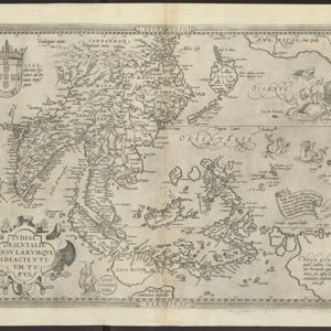
Indiae Orientalis insularumque adiacientium typus
1579
Brunei, Cambodia, East Timor, Indonesia, Laos, Malaysia, Myanmar, Philippines, Singapore, Southeast Asia, Thailand, Vietnam
A banner at the right features text that notes that the ‘Insule Molucce’ (Maluku Islands) are famous for their abundance of spices, which are sold across the world. There are also Illustrations of mermaids and sea monsters wrecking a ship.

Indiae Orientalis insularumque adiacientium typus
1579
Brunei, Cambodia, East Timor, Indonesia, Laos, Malaysia, Myanmar, Philippines, Singapore, Southeast Asia, Thailand, Vietnam
A red banner at the right features text that notes that the ‘Insule Molucce’ (Maluku Islands) are famous for their abundance of spices, which are sold across the world. There are also Illustrations of mermaids and sea monsters wrecking a ship.

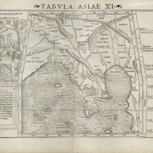
Tabvla Asiae XI
1574
Cambodia, Indonesia, Malaysia, Laos, Myanmar, Singapore, Thailand, Vietnam, Southeast Asia
Mid-16th century map by Girolamo Ruscelli, based on the work of 2nd century geographer Ptolemy. It is difficult to pinpoint exact locations, but the Malay Peninsula is recognisable. Italian text on the reverse describes the region.
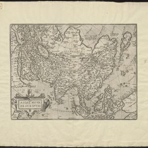
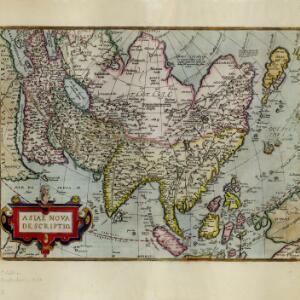
Asiae nova descriptio
1570
Brunei, Cambodia, East Timor, Indonesia, Laos, Malaysia, Myanmar, Philippines, Singapore, Southeast Asia, Thailand, Vietnam
Map of Asia featuring mythical lakes that were once thought to exist in southern China—including ‘Caÿamaÿ Lacus’—and which feed several rivers that flow south through mainland Southeast Asia. Carvings of people and animals decorate the cartouche.

Tabvla Asiae XI
1561
Cambodia, Indonesia, Malaysia, Laos, Myanmar, Singapore, Thailand, Vietnam, Southeast Asia
Mid-16th century map by Girolamo Ruscelli, based on the work of 2nd century geographer Ptolemy. It is difficult to pinpoint exact locations, but the Malay Peninsula is recognisable. Italian text on the reverse describes the region.
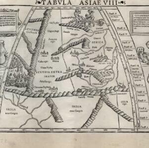

Tabvla Asiae XI
c.1542-1552
Cambodia, Indonesia, Malaysia, Myanmar, Singapore, Thailand, Vietnam, Southeast Asia
Early map by Sebastian Münster, based on the work of 2nd century geographer Ptolemy. The Malay Peninsula—labelled ‘Aurea Chersonesus [Golden Chersonese]’—is recognisable. An illustration shows the local animals: a tiger, cockerels and a white parrot.
- Filter from 1478 to 1840
- Indonesia199
- Malaysia182
- Myanmar173
- Vietnam170
- Cambodia168
- Singapore168
- Thailand168
- Laos164
- Philippines160
- Brunei158
- Southeast Asia158
- East Timor148
- more Simple Location »
- [remove]Longitude and Latitude212
- Scale110
- Compass Rose101
- Written Note/Details76
- Rhumbline Network53


