A mid-19th century map of the city of Soerabaija (Surabaya, East Java, Indonesia) showing its recently built defences, including the ‘Citadel Prins Hendrik’ fort and a walled moat. Outside the city are villages, plantations and fields.
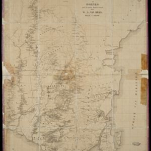
Kaart van de Zuider- en Ooster Afdeeling van Borneo
eventc.1865
location_onIndonesia
Map of the South and East Department of Borneo, focusing on the rivers and settlements along the rivers. The names of local districts are also printed on the map.