
Search Results
Filter
Map Attributes
Longitude and Latitude
Remove constraint Map Attributes: Longitude and Latitude
Political Regions
National Border
Remove constraint Political Regions: National Border
Transport Hubs
Railway Station
Remove constraint Transport Hubs: Railway Station
Collections
Bodleian Libraries, University of Oxford
Remove constraint Collections: Bodleian Libraries, University of Oxford
4 Results found

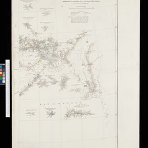
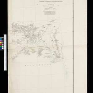

South eastern frontier
c.1890-1906
Myanmar, Thailand
Very detailed large-scale map of the southeast border of Burma (Myanmar) and Siam (Thailand), divided into districts. Spread over multiple sheets, seems incomplete (some sheets appear more than once, probably from different versions of the same map).
- [remove]Railway Station4
- [remove]National Border4
- Colonial Possessions1
- District/Administrative Border1
- [remove]Longitude and Latitude4
- Scale4
- Written Note/Details3
- Contour Lines/Elevation1


