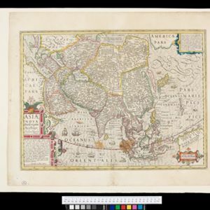
Asia divided into its principall regions in which may be seen the extent of the Empires, Monarchies, Kingdoms and States which at present divide Asia
event1680
location_onBrunei, Cambodia, East Timor, Indonesia, Laos, Malaysia, Myanmar, Papua New Guinea, Philippines, Singapore, Southeast Asia, Thailand, Vietnam
[Chart of the Indian Ocean]
event1682
location_onCambodia, Indonesia, Malaysia, Myanmar, Singapore, Thailand
[Chart of the Indian Ocean]
event1684
location_onCambodia, Indonesia, Malaysia, Myanmar, Thailand
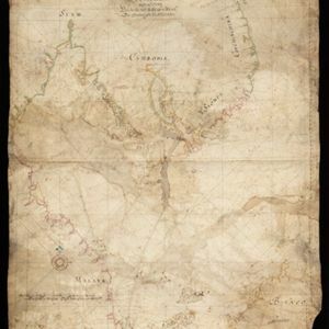
[Portolan chart of the Gulf of Siam]
event1697
location_onThailand, Vietnam, Malaysia, Cambodia
[Dutch portolan chart of the eastern Dutch East Indies]
event1700
location_onIndonesia, East Timor
[Dutch Portolan chart of the Java Sea]
eventc.1700
location_onIndonesia
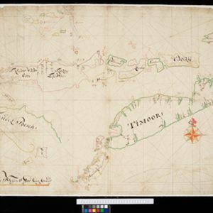
[Dutch portolan chart of the Lesser Sunda Islands]
eventc.1700
location_onIndonesia, East Timor
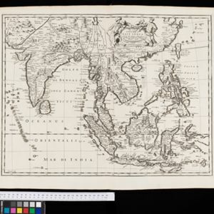
A new map of the East Indies: taken from M. de Fer's map of Asia, shewing their cheif divisions, cities, towns, ports, rivers, mountains &c.
event1701
location_onBrunei, Cambodia, East Timor, Indonesia, Laos, Malaysia, Myanmar, Vietnam, Thailand, Southeast Asia, Singapore, Philippines