
Search Results
4 Results found

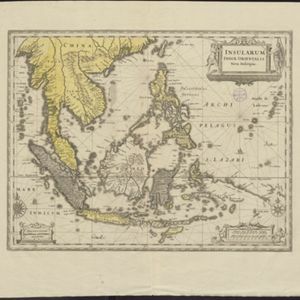
Insularum Indiæ orientalis nova descriptio
c.1700
Brunei, Cambodia, East Timor, Indonesia, Laos, Malaysia, Myanmar, Philippines, Singapore, Southeast Asia, Thailand, Vietnam
The outline of the island of New Guinea is very vague on this early 17th century map of Southeast Asia. The cartouche is decorated with two figures of Asian warriors: one holds a spear, the other a sword. There are also drawings of mermaids.
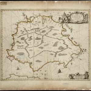
Insula Borneo et occidentalis pars Celebis cum adjacentibus insulis
1657
Indonesia
The orientation of this map is unusual, with north to the right, so the west coast of Borneo is at the top. Its cartouche is decorated with drawings of seafaring people, and the scale with cherubs playing with cartography tools such as callipers.
- [remove]Jungle/Wooded Area4
- Mountain/Volcano4
- Compass Rose4
- Longitude and Latitude4
- [remove]Rhumbline Network4
- Scale4


