Search

Search Results

Map to illustrate the Siamese question: showing the present limits of French claims, and the additional territory now demanded

event1893

location_onCambodia, Laos, Malaysia, Myanmar, Thailand, Vietnam

Map highlighting areas of eastern Siam (Thailand) claimed by France. Notes describe Siam’s geography, government, population, military and trade (rice, teak, pepper, bullocks, fish, hides, tin, cardamom, tin), including trading partners by tonnage.

Nederlandsch Oost-Indië

event1865

location_onBrunei, Cambodia, East Timor, Indonesia, Laos, Malaysia, Myanmar, Vietnam, Thailand, Southeast Asia, Singapore, Philippines, Papua New Guinea

This detailed map of the Dutch East Indies in the mid-19th century contains a great deal of information: topographical details, settlements and administrative areas, roads, railways and maritime routes, telegraph lines, inset maps etc.

Map of Prince of Wales' Island or Pulo Penang and province Wellesley

event1853

location_onMalaysia

Map of the Penang Strait, including written instructions on how to navigate the strait. On land, areas of cultivation are marked, with a table listing acreage used for each crop. A boundary with Siam based on an 1831 treaty is also shown.

Algemeene Kaart van Nederlandsch Oostindie

event1842

location_onEast Timor, Indonesia, Malaysia, Singapore

This detailed map of the Dutch East Indies in the mid-19th century is spread over eight sheets, plus a cover sheet showing the whole area. There are numerous inset maps of islands, bays, cities etc.

Algemeene kaart van Nederlandsch Oostindie

eventc.1839-1855

location_onEast Timor, Indonesia, Malaysia, Singapore

This map of the Dutch East Indies is spread over eight sheets, with a hand-drawn cover sheet showing the whole area. There are numerous inset maps of islands, bays, cities etc. Two of the inset maps have a replacement map pasted over them.

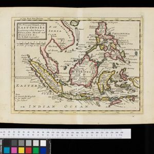
The principal islands of the East-Indies: explaining what belongs to England, Spain and Holland &c.

eventc.1732

location_onBrunei, Cambodia, East Timor, Indonesia, Philippines, Malaysia, Thailand, Vietnam, Singapore, Southeast Asia

The letters ‘E’ or ‘D’ are marked after place names to indicate if they are English or Dutch colonial possessions: e.g. ‘Marleborough Fort E’ on Sumatra or ‘Concordia Fort D’ on Timor. The Philippines are labelled ‘to Spain’.

The principal islands of the East-Indies: explaining what belongs to England, Spain and Holland &c.

event1732

location_onBrunei, Cambodia, East Timor, Indonesia, Philippines, Malaysia, Thailand, Vietnam, Singapore, Southeast Asia

The letters ‘E’ or ‘D’ are marked after place names to indicate if they are English or Dutch colonial possessions: e.g. ‘Marleborough Fort E’ on Sumatra or ‘Concordia Fort D’ on Timor. The Philippines are labelled ‘to Spain’.

close