
Search Results


A map of British North Borneo
1894
Malaysia, Brunei, Indonesia
The colonial territories of British North Borneo are shown in pink on this late 19th century map, with Brunei and Sarawak in green, and Dutch colonial territory in yellow. Sea routes around the British Empire are depicted on an inset map.


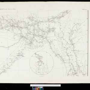
Map of the Johore Territory 1893
1894
Malaysia, Singapore
Map of the Malay state of Johor, and Singapore. The route of a proposed railway north from Johor Bahru is shown. Apart from rivers and mountains, much of the terrain is blank, with labels such as ‘Unexplored Hill Country’ or ‘Dense Jungle and Swamp’.

Trade Routes in the Far East
1894
Brunei, Cambodia, Indonesia, Laos, Malaysia, Myanmar, Philippines, Singapore, Thailand, Vietnam
Map of stream ship trade routes around Southeast Asia. Rivers, railways, submarine telegraph cables, lighthouses (fixed, revolving and flashing), graving docks and coaling stations are marked. An inset map shows a railway route from Britain to Asia.

Queensland & British New Guinea
c.1894-1897
Indonesia, Papua New Guinea
The first two sheets of this eight-sheet map focus on British New Guinea, with German and Dutch colonial areas of New Guinea also shown in part. There is a line marking a proposed change in border between Dutch and British territory.

Map to illustrate Mr. W.R.D. Beckett's route, Novr. 1891-April 1892
1893
Vietnam, Thailand, Cambodia, Laos
The route of W.R.D. Beckett between Bangkok and Saigon, partly along the Mekong River, is marked on this map, along with trade routes, police posts, mines (copper, iron, gold), and products (the spice cardamom, and resin benzoin (‘Gumbenjamin’)).


Facsimile of map given to the French Ambassador 29th Aug. 1889 as indicating the Approximate Boundaries of Siam to the North West & North such as they have hitherto been considered
1893
Cambodia, Laos, Myanmar, Thailand, Vietnam
The border between Siam (Thailand) and Tenasserin (Tanintharyi Region, Myanmar) is highlighted on this map, while the more northerly border between Siam and Burma (Myanmar) is marked as being ‘approximate’.


