
Search Results


Kaart van de residentie Oostkust van Sumatra
1889
Indonesia
Detailed topographical map of the east coast of Sumatra, spread over 34 sheets. The area’s farms are listed and shown on the map, with types of crop grown. With five inset maps of individual towns. Two sheets and the cover sheet are missing.

Kaart van de residentie Oostkust van Sumatra
1889
Indonesia
Detailed topographical map of the east coast of Sumatra, spread over 36 sheets plus a cover sheet of the whole area. Mountains and forests dominate, with villages, routes and administrative borders shown. With five inset maps of individual towns.

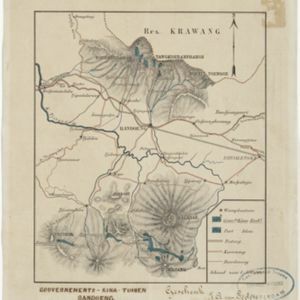
Kaart van de Afdeeling Deli der residentie Oostkust van Sumatra
1887
Indonesia
A map of the department of Deli, Java, divided into administrative districts, and spread over eight sheets. Rivers, railways, roads and paths, forests and mountains, and crops—rice, coconut, pepper, nutmeg, alang-alang—are marked.


Kaart van Deli: Afdeeling der residentie Oostkusst van Sumatra
1884
Indonesia
Map of Deli on the east coast of Sumatra, dominated by the numerous rivers that flow from the mountains in the southwest to the Strait of Malacca. The railway lines around the city of Medan are shown in red, and flags indicate a military garrison.

Topographische kaart der residentie Soerabaja
1884
Indonesia
The residency of Soerabaja, East Java, featuring crops (coffee, coconut, sugarcane, rice, alang-alang, bamboo) and fishing ponds. Three inset maps: a triangulation map; a map of distances between settlements by types of transport; Bawean Island.


Handelskaartje van den Nederlandsch Indischen archipel
1883
Indonesia, East Timor
This map is concerned with trade in the Dutch East Indies, highlighting useful resources such as maritime routes, railways, telegraph lines and offices, coast and harbour lights, offices of officials, areas that apply tolls and duties etc.

- [remove]Dutch East Indies44
- Java26
- Sumatra18
- Soerabaja8
- Surabaya8
- Aceh6
- Banda Aceh6
- Batavia5
- Jakarta5
- Madura5
- Oostkust van Sumatra5
- Asahan4
- more Detailed Location »


