Search

Search Results

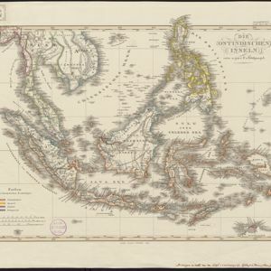
Die Ostindischen Inseln

event1846

location_onBrunei, Cambodia, East Timor, Indonesia, Laos, Malaysia, Myanmar, Philippines, Singapore, Southeast Asia, Thailand, Vietnam

Map of Southeast Asia highlighting the colonial possessions of the Netherlands (Dutch East Indies), Spain (Philippines), Britain (Straits Settlements, Burma, part of Borneo) and Portugal (East Timor). From the German atlas ‘Stielers Handatlas’.
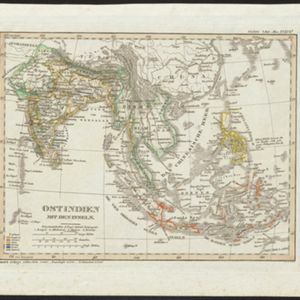
Ost-Indien mit den Inseln

eventc.1835

location_onBrunei, Cambodia, East Timor, Indonesia, Laos, Malaysia, Myanmar, Philippines, Singapore, Southeast Asia, Thailand, Vietnam

On this map of India and Southeast Asia, borders are outlined and cities underlined in different colours to show the colonial territories of the European powers. On Borneo, the names of indigenous peoples are listed (‘Dayak’s, Papua’s, Bugi’s’).

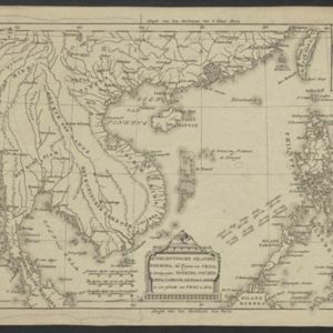
De Philippynsche eilanden, Formosa, het Zuijden van China, de Koninkrijken Tonking, Cochinchina, Camboge, Siam, der Lahos en een gedeelte van Pegu en Ava

eventc.1784

location_onCambodia, Laos, Malaysia, Myanmar, Philippines, Thailand, Vietnam

The arrows on this map mark the direction of the seasonal monsoons experienced in the South China Sea and Philippine Sea during the late 18th century. Each arrow has a label indicating the month.

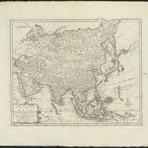
Nieuwe en naukeurige kaart van Asia

event1773

location_onIndonesia, Brunei, Cambodia, East Timor, Laos, Malaysia, Myanmar, Papua New Guinea, Philippines, Singapore, Southeast Asia, Thailand, Vietnam

Map of Asia featuring an early—and very vague—depiction of New Britain (‘Nieuw Brittanje’) which was named by the British explorer William Dampier when he visited in 1700. The ‘Straat van Dampier’ is also shown, dividing New Britain from New Guinea.

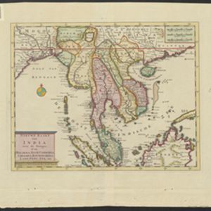
Nieuwe kaart van India over de Ganges: of van Malakka, Siam, Cambodia, Chiampa, Kochinchina, Laos, Pegu, Ava enz.

event1739

location_onBrunei, Cambodia, Indonesia, Laos, Malaysia, Myanmar, Singapore, Thailand, Vietnam, Philippines

On this map, mainland Southeast Asia is divided into regions such as Cochin China, Ciampa and Tunquin (modern Vietnam), Siam (Thailand), Pegu, Aracan and Ava (Myanmar), Malacca (Malaysia), Laos and Cambodia. Rivers and settlements are also shown.

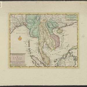
Nieuwe kaart van India: over de Ganges, of van Malakka, Siam, Cambodia, Chiampa, Kochinchina, Laos, Pegu, Ava enz.

event1739

location_onBrunei, Cambodia, Indonesia, Laos, Malaysia, Myanmar, Singapore, Thailand, Vietnam, Philippines

On this map, mainland Southeast Asia is divided into regions such as Cochin China, Ciampa and Tunquin (modern Vietnam), Siam (Thailand), Pegu, Aracan and Ava (Myanmar), Malacca (Malaysia), Laos and Cambodia. Rivers and settlements are also shown.

Nieuwe kaart van Asia na de alderlaatste ondekking int licht gebracht

event1733

location_onBrunei, Cambodia, East Timor, Indonesia, Laos, Malaysia, Myanmar, Papua New Guinea, Philippines, Singapore, Southeast Asia, Thailand, Vietnam

Map of Asia showing New Guinea (‘Nieuw Guinee’) and Australia (‘Nieuw Holland’) as one landmass, demonstrating that there was some uncertainty about the area’s geography in the early 18th century. However, it does include New Britain (‘N. Bretanje’).

close

  • Filter from 1595 to 1846

Current results range from 1595 to 1846