Search

Search Results

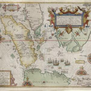
Nova tabula insularum Iavae, Sumatrae, Borneonis et aliarum Mallaccam usquae

event1598

location_onMalaysia, Indonesia, Singapore

Adapted by Theodore de Bry from an original by Willem Lodewycksz, this map has some inaccuracies e.g. the Malay Peninsula (‘Chersonese’) is completely bisected by the Muar River, leaving the southern tip of the peninsula as a separate island.

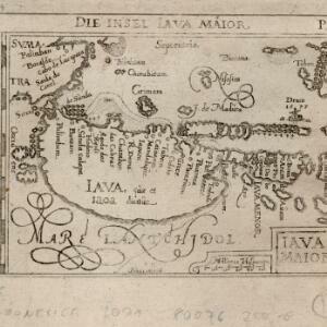
Iava Maior

eventc.1590-1650

location_onIndonesia

The line of settlements along the north coast of Java—contrasting with the almost empty interior—show that this map’s focus is on the sea. The islands, shoals and reefs that are marked, and the drawings of ships, reinforce this idea.

close

  • Filter from 1590 to 1598

Current results range from 1590 to 1598