Search

Search Results

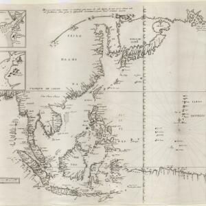
[Map of the East Indies]

event1666

location_onVietnam, Myanmar, Papua New Guinea, Philippines, Singapore, Southeast Asia, Thailand, Malaysia, Laos, Indonesia, East Timor, Cambodia, Brunei

This mid-17th century map of Southeast Asia has a maritime focus, with shoals and reefs, and the coastal areas marked in great detail, while the interiors remain mostly blank. The Great Wall of China can be seen at the top of the map.

[Philippine Islands]

event1665

location_onPhilippines

A map of the northern Philippine islands with a rhumbline network, a web of lines to aid navigation. Bathymetry (sea depth), shoals and reefs are marked, reinforcing the maritime theme. The compass rose points left, indicating north’s direction.

Straat Sincapura

eventc.1650

location_onSingapore, Indonesia

Hand-drawn map of the Singapore Strait, with Singapore above (green coastline) and the Riau Archipelago below. Bathymetry (sea depth), shoals and reefs are marked. Two mountains at the eastern end of the strait are shown in profile as landmarks.

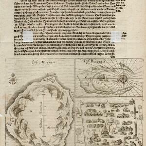
Ins: Macjan, Ins: Bactjan

eventc.1631-1657

location_onIndonesia

These pages are probably from ‘Newe Welt und Americanische Historien’ by Johann Gottfried. There are maps of Pulau Makian (‘Ins. Macjan’) and Pulau Bacan (Ins. Bacjan) in the Maluku Islands, and a plan of a fort on Makian.

close