
Search Results


Kaart van het gebied bezet in Groot-Atjèh
1898
Indonesia
A six-sheet map of Groot-Atjèh (Aceh, northern Sumatra) focusing on areas occupied during the Aceh War (1873–1904) between the Sultanate of Aceh and Dutch colonists. It shows military positions and fortifications, buildings, routes and crops.

Kaart der hoofdplaats Batavia omstreeks het jaar 1740
1898
Indonesia
A mid-18th century map of the important port of Batavia (Jakarta), with military forts, a pier, hospitals, churches, and residential streets. However, the city is also surrounded by fields and plantations, for producing crops and grazing animals.


Kaart van Batavia omstreeks 240 jaren geleden overgebracht in 1864
1898
Indonesia
Although published in the 19th century, this is a copy of a much earlier map of Batavia (Jakarta) from c.1625. It focuses on the castle and fortifications, but also shows the fields of crops and wetlands surrounding the city.


Kaart van de residentie Wester-afdeeling van Borneo
1898
Indonesia
Topographical map of western Borneo. Larger settlements are marked with their height above sea-level and with a flag to indicate a military garrison. They also have a letter signifying the local ruler, from Sultan to Lauthai (village elder).

Kaart de residentie Wester-afdeeling van Borneo
1898
Indonesia
Topographical map of western Borneo, with inset maps of the islands off the west coast, and of the city of Pontianak including the docks and crops grown near the city (rice, coconut, mangosteen, sago, alang-alang, indigo plant, sugarcane, bamboo).

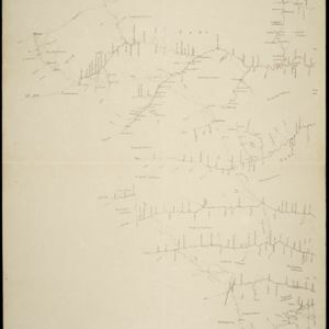
Kaart van het gebied bezet in Groot-Atjèh
1898
Indonesia
A large-scale map of Groot-Atjceh, northern Sumatra, spread over six sheets, and featuring details such as routes, crops (rice, banana, sugarcane, alang-alang, bamboo), mountains and wetlands, and settlements (city of Kota Radja (modern Banda Aceh)).

Kaart van het kasteel en de stad Batavia in het jaar 1667
1898
Indonesia
Very detailed map of the port city of Batavia (Jakarta), with numerous locations listed in the multiple legends. The city’s coat of arms—featuring a sword and laurel wreath—and the Dutch East India Company monogram logo—letters ‘VOC’—are also shown.
- Filter from 1535 to 1900
- Indonesia904
- Malaysia459
- Myanmar427
- Thailand419
- Singapore385
- Vietnam382
- Cambodia359
- Brunei339
- Philippines337
- Laos335
- East Timor295
- Southeast Asia277
- more Simple Location »
- Port173
- Pier74
- Railway Station56
- River884
- Road377
- Path201
- Railway/Tramway177
- Postal Route92
- Canal83
- Bridge69
- Telegraph/Telephone60
- Legend524
- Inset Map276
- Cartouche249
- Illustration189
- Elevation115
- Coat of Arms106


