Search

Search Results

Kaart van de dichtheid van bevolking van Java en Madoera

event1892

location_onIndonesia

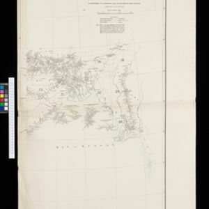
This map shows the population density of Java and Madura in 1892. The area is divided into regencies, which are then subdivided into districts, with the districts shaded to represent its population. Each district is also listed under its regency.

Kaart van den op Java en Madoera reeds in gebruik genomen grond

event1892

location_onIndonesia

Land usage statistics are shown on this map of Java and Madura. The amount of land used in each district is indicated by green hash marks, and by a number giving its land use percentage. District names are listed and identified by a letter.

Burma and adjacent countries

event1892

location_onMyanmar, Thailand

The regional and national borders of Burma and Siam are hand-coloured on this map. Provinces, districts and states within Burma are also highlighted, and itemised in a separate list.

Burma and adjacent countries

event1892

location_onMyanmar, Thailand

The regional and national borders of Burma and Siam are hand-coloured on this map. Provinces, districts and states within Burma are also highlighted, and itemised in a separate list.

India shewing railways with stations

event1892

location_onMyanmar

This map focuses on India, but also includes Burma (Myanmar), showing the country’s railway lines with their stations, including engine changing stations and junction stations. Part of a series of maps charting the development of the railway system.

Kaart van de Residentie Kediri

event1891

location_onIndonesia

A map of the residency of Kediri (East Java) divided into regencies, which are then subdivided into districts. Mountains, roads, railways and rivers are shown. An inset map shows distances between settlements by road, tracks and paths.

Kaart van het gebied bezet in Groot-Atjeh

event1891

location_onIndonesia

A map of Groot-Atjceh and the city of Kota Radja (modern Banda Aceh) at the northern tip of Sumatra, detailing routes (rivers, roads, railways), crops (rice, banana, sugarcane, betel, reed, alang-alang, bamboo) and land features (forests, wetlands).

British Burma, Pegu division: With additions to railways up to 1891

event1891

location_onMyanmar

Topographical map of the Pegu Division of British Burma (Myanmar), spread over four sheets. In addition to mountains, forests, rivers and wetlands, rice fields, routes (road, railway, path, telegraph), villages and pagodas are marked.

Map to show lines of advance on Manipur

event1891

location_onMyanmar

Map of three routes taken by British troops through the mountains to the Indian city of Manipur (Imphal) during the Anglo-Manipur War of 1891. The map includes part of Burma to the east.

Kaart van den Nederlandsch-Indischen Archipel

event1890

location_onIndonesia, East Timor, Brunei, Cambodia, Malaysia, Philippines, Singapore, Southeast Asia, Thailand, Vietnam

The seas of the Dutch East Indies are the focus of this map, with maritime routes, sea temperature, sea depth, currents and monsoons shown. There are graphs of population by ethnicity, agriculture and livestock, trade and shipping, and trade exports.

Kaart van het eiland Flores

event1890

location_onIndonesia

Hand-drawn map of Flores in the Lesser Sunda Islands, with extensive written notes describing the island, e.g. the interior is unknown to Europeans; the names of the main Christian villages are underlined.

Kaart der Bataklanden en van het eiland Nijas

event1890

location_onIndonesia

A large-scale map of northern Sumatra, spread over 16 sheets, and divided into administrative regions. The island of Nijas (Nias) is marked with the locations of local tribes, and there is a list of other maps referenced in producing the map.

close