Search Results

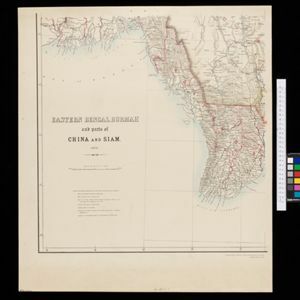
Eastern Bengal, Burmah and parts of China and Siam
1871
Myanmar, Laos, Thailand, Vietnam
The routes of nine expeditions (1830 to 1869) are marked on this map. There are also short notes about trading (e.g. at Oonoung in Burmah: ‘A bazaar, with a great variety of European goods’), and a list of other maps referenced in producing the map.

Map of the River of Don-nai from Cape St. James to the city of Saigon
1820
Vietnam
A map to aid in the navigation of the rivers leading to Saigon (Ho Chi Minh City, Vietnam). Details include bathymetry (water depth), currents, and a side view (or ‘elevation’) of hills to use as a landmark. Tides are described in written remarks.
- Longitude and Latitude3
- [remove]Scale3
- [remove]Written Note/Details3
- Contour Lines/Elevation2


