Search

Search Results

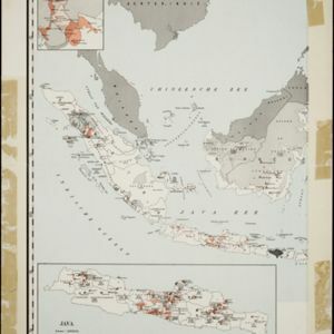
Kaart van den Nederlandsch Oost Indischen archipel aantoonende de door de Inlandsche bevolking beleden godsdiensten

event1896

location_onIndonesia

A map of the religions of the local peoples of the Dutch East Indies, with areas marked as Christian, Muslim, ‘heathen’. With population figures, including for Protestants and Catholics, and locations of missionaries and other religious teachers.

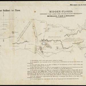
Midden-Flores (Terrein van actie der Noord-Flores-expeditie)

event1890

location_onIndonesia

Map of central Flores in the Lesser Sunda Islands, with extensive written notes describing the island, e.g. where the first Christians settled; the territories of local rulers; areas where Christians were replaced by Muslims; locations of tin mines.

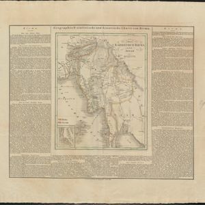
Das Kaiserthum Birma nebst Assam

event1825

location_onMyanmar, Malaysia, Thailand

Map of the Birman Empire and Assam (modern Myanmar) with detailed text describing the region’s geography, culture, population, religion, government and history. There is an inset map highlighting Burmese islands off the coast of the Malay Peninsula.

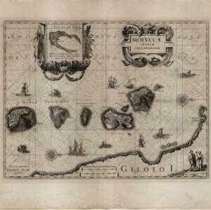
Molvccae insvlae celeberrimae

eventc.1640-1655

location_onIndonesia

This small island chain off the west coast of Gilolo (Halmahera in the Maluku Islands, Indonesia), was an important area for the spice trade. Latin text on the reverse describes the trade/islands. North is located to the right, rather than the top.

close

  • Filter from 1640 to 1896

Current results range from 1640 to 1896