Search

Search Results

Western part of the Java Sea : from Lucipara I. to Sunda Strait and Batavia

event1866

location_onIndonesia

Designed to aid navigation around the western Java Sea, this map features bathymetry (sea depth), current and tide data, and is marked with shoals, reefs and other hazards. Written notes add details at specific locations (e.g. ‘heavy tide rips’).

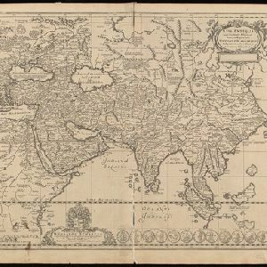
Asia antiqua cum finitimis Africae et Europae regionibus

event1652

location_onIndonesia, Malaysia, Brunei, Philippines, Cambodia, Vietnam, Thailand, Laos, Myanmar, Southeast Asia, Singapore

This mid-17th century map of Asia is missing most of the southern and eastern parts of Southeast Asia, such as the Philippines and most of modern Indonesia. Instead, there is a note stating that there are reported to be numerous islands in the area.

close

  • Filter from 1652 to 1866

Current results range from 1652 to 1866