Search

Search Results

Noordkust Java: Westervaarwater van Soerabaja

event1898

location_onIndonesia

This map of the Madura Strait between Java and Madura is designed to aid navigation: bathymetry (water depth), lighthouses, shoals and reefs, rocks and mud, anchor points, and landmark mountains are all marked. Text describes the tidal conditions.

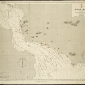
Straat Banka: Zuidblad

event1897

location_onIndonesia

Navigation map of the southern part of the Bangka Strait between Sumatra and Bangka Island. Bathymetry (sea depth), lighthouses, reefs, shoals and other obstructions (clay, coral, mud, stones, sand) are marked.

Atlas van Nederlandsch Oost-Indië

eventc.1897-1904

location_onIndonesia

Very detailed atlas of the entire Dutch East Indies, over 16 map sheets, with a cover and overview map. Includes topographic maps, inset maps of cities and islands, and maps featuring land and sea routes, languages, geology, colonial territory etc.

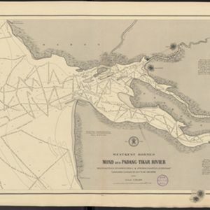
Westkust Borneo: Mond der Padang-Tikar rivier

event1884

location_onIndonesia

Navigation map of the mouth of the Padang Tikar River, on the west coast of Borneo, featuring bathymetric (water depth) routes. Obstructions are marked with letters: ‘m’ (mud), ‘z’ (sand). Trees, hills and fishermen’s houses are shown as landmarks.

Algemeene kaart van Nederlandsch Oostindie

eventc.1839-1855

location_onEast Timor, Indonesia, Malaysia, Singapore

This map of the Dutch East Indies is spread over eight sheets, with a hand-drawn cover sheet showing the whole area. There are numerous inset maps of islands, bays, cities etc. Two of the inset maps have a replacement map pasted over them.

Mapa de las Yslas Philipinas

event1744

location_onIndonesia, Philippines

First published in 1734, and commonly known as the ‘Velarde map’, this map by the Spanish cartographer Pedro Murillo Velarde is regarded as the first important map of the Philippines. This is a later version, lacking 12 drawings on the map's sides.

Der Hollaendisch-Ostindianischen Compagnie weltberühmte Haupt-Handels und Niederlags: Stadt Batavia

event1733

location_onIndonesia

The legend and written notes on this plan of Batavia (Jakarta) provide much detailed information about the important port city in the early 18th century. It is also beautifully decorated with paintings of the city, local people, animals and ships.

A map of the East-Indies and the adjacent countries: with the settlements, factories and territories, explaning what belongs to England, Spain, France, Holland, Denmark, Portugal &c.

eventc.1720

location_onBrunei, Cambodia, East Timor, Indonesia, Laos, Malaysia, Myanmar, Philippines, Singapore, Southeast Asia, Thailand, Vietnam

This map showcases the colonial territories of Southeast Asia in the 18th century, with text detailing trading information and the products of each region. There are five inset maps featuring plans of specific trading ports.

To the Right Honourable William, Lord Cowper, Lord High Chancellor of Great Britain, this map of Asia

eventc.1715

location_onVietnam, Myanmar, Papua New Guinea, Philippines, Singapore, Southeast Asia, Thailand, Malaysia, Laos, Indonesia, East Timor, Cambodia, Brunei

The arrows on this map show the direction of the seasonal monsoons: each arrow has a label, indicating the month. The northeast coast of Borneo is labelled ‘A Desart [desert/deserted?] Coast’, while the south is labelled ‘Pepper Country’.

close

  • Filter from 1715 to 1898

Current results range from 1715 to 1898