
Search Results
Filter
Map Attributes
Written Note/Details
Remove constraint Map Attributes: Written Note/Details
Insets
Inset Map
Remove constraint Insets: Inset Map
Land Routes
River
Remove constraint Land Routes: River
Detailed Location
Dutch East Indies
Remove constraint Detailed Location: Dutch East Indies
Printer/Publisher
A.J. Bogaerts
Remove constraint Printer/Publisher: A.J. Bogaerts
5 Results found


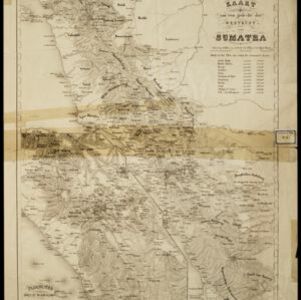
Kaart van een gedeelte der Westkust van Sumatra
1855
Indonesia
Hachures—short lines/dashes that give a sense of the shape and steepness of terrain—are used to show the mountains of Sumatra’s west coast, and of the Padang Highlands and Lowlands. Text lists the heights of some of the region’s chief mountains.


- Filter from 1855 to 1858
- Contour Lines/Elevation5
- Longitude and Latitude5
- Scale5
- [remove]Written Note/Details5


