Search

Search Results

Nova Totius Asiae Tabula

eventc.1750

location_onBrunei, Cambodia, East Timor, Indonesia, Laos, Malaysia, Myanmar, Philippines, Singapore, Southeast Asia, Thailand, Vietnam

This elaborately illustrated map of Asia is decorated with images of angels and cherubs, various figures dressed in colourful robes, wild animals, a procession including elephants and camels, and a double hemisphere world map.

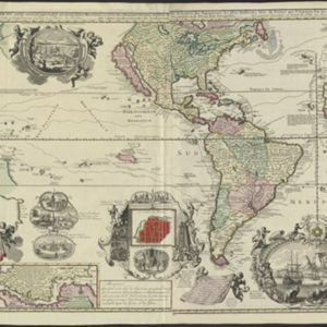
Carte nouvelle de la Mer du Sud

event1730

location_onEast Timor, Indonesia, Papua New Guinea, Philippines, Vietnam

This elaborately illustrated map of the Atlantic and Pacific Oceans includes the eastern islands of Southeast Asia. The routes of five expeditions west across the Pacific are marked, including that of Ferdinand Magellan to the Philippines in 1520.

Insulae Iavae pars Occidentalis

event1728

location_onIndonesia

A map of Java with mountains, jungles, animals and crops. Bathymetry (sea depth) is marked, including on an inset map of Batavia harbour. Illustrations include Batavia Castle, and a lion—representing Belgium—receiving tribute and enslaving locals.

Insulae Iavae pars Occidentalis

eventc.1720

location_onIndonesia

A map of west Java with mountains, jungles, animals and crops. Details include sea depth, an inset map of Batavia harbour, and an illustration of a lion—representing Belgium—receiving tribute and enslaving locals. A similar map of east Java was made.

Insulae Iavae Pars Occidentalis / Insulae Iavae Pars Orientalis

eventc.1720

location_onIndonesia

A map of Java with mountains, jungles, animals and crops. Bathymetry (sea depth) is marked, including on an inset map of Batavia harbour. Illustrations include Batavia Castle, and a lion—representing Belgium—receiving tribute and enslaving locals.

Insulae Iavae pars Occidentalis

eventc.1710-1719

location_onIndonesia

A map of Java with mountains, jungles, animals and crops. Bathymetry (sea depth) is marked, including on an inset map of Batavia harbour. Illustrations include Batavia Castle, and a lion—representing Belgium—receiving tribute and enslaving locals.

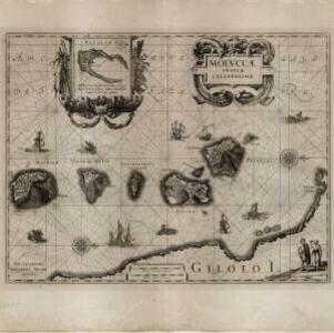
Molvccae insvlae celeberrimae

eventc.1640-1655

location_onIndonesia

This small island chain off the west coast of Gilolo (Halmahera in the Maluku Islands, Indonesia), was an important area for the spice trade. Latin text on the reverse describes the trade/islands. North is located to the right, rather than the top.

close