Search

Search Results

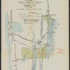
Sketch showing positions of 1st Brigade, 2nd Division, 8th Corps, in operations against Manila

event1900

location_onPhilippines

Created by the U.S. Army, this map of a small area south of Manila records Spanish and American trenches and troop and gun locations on the last day of the Spanish–American War (13 August 1898). Ground conditions (swamps, jungle, fields) are noted.

Map of the Island of Singapore and its dependencies

event1898

location_onSingapore

Map of Singapore Island, divided into Districts, including the surrounding islands and straits. The city centre, roads and forests are marked. MacRitchie Reservoir is at the centre of the island, with coconut plantations along the east coast.

City of Mandalay and environs

event1894

location_onMyanmar

Map of the Burmese city of Mandalay on the Irrawaddy River. The city has a grid of roads and buildings, dominated by Fort Dufferin (formerly Mandalay Palace). The surrounding country has villages, crops, agricultural ponds and irrigation channels.

New Sketch Map of the Protected Malay State of Perak

event1892

location_onMalaysia

Map of the state of Perak (Malay Peninsula) with a table of statistics: area, population, road/railway/river lengths, revenue, tin exports. Gold and tin mines are marked, and the Straits Settlements are highlighted in red.

New sketch map of the protected Malay State of Perak

event1892

location_onMalaysia

Map of state of Perak (Malay Peninsula) with a table of statistics: area, population, road/railway/river lengths, revenue, tin exports. Straits Settlements highlighted red. Someone has added handwritten travel times/distances by steamer/road/train.

British Burma, Pegu division: With additions to railways up to 1891

event1891

location_onMyanmar

Topographical map of the Pegu Division of British Burma (Myanmar), spread over four sheets. In addition to mountains, forests, rivers and wetlands, rice fields, routes (road, railway, path, telegraph), villages and pagodas are marked.

Map of Prince of Wales' Island or Pulo Penang and province Wellesley

event1853

location_onMalaysia

Map of the Penang Strait, including written instructions on how to navigate the strait. On land, areas of cultivation are marked, with a table listing acreage used for each crop. A boundary with Siam based on an 1831 treaty is also shown.

Map of the River of Don-nai from Cape St. James to the city of Saigon

event1820

location_onVietnam

A map to aid in the navigation of the rivers leading to Saigon (Ho Chi Minh City, Vietnam). Details include bathymetry (water depth), currents, and a side view (or ‘elevation’) of hills to use as a landmark. Tides are described in written remarks.

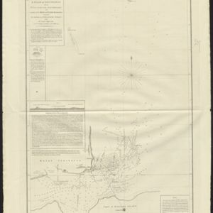
A plan of soundings from Pulo Aor to the Southward, and outside of the Reef off Point Romania towards the entrance of Sincapour Strait

event1818

location_onMalaysia, Indonesia, Singapore

Navigation chart of part of the South China Sea leading to the eastern entrance of the Singapore Strait. Features bathymetry (sea depth), anchor points, shoals and other obstructions, landmark hills, and detailed explanatory notes.

A map of Java: chiefly from surveys made during the British administration

event1817

location_onIndonesia

Made for ‘A History of Java’ by Sir Stamford Raffles, this map includes a list of administrative districts with their populations, and four inset maps of harbours. Another inset map shows rocks and minerals, mountains and volcanoes, and teak forests.

close

  • Filter from 1817 to 1900

Current results range from 1817 to 1900