Search Results
Filter
Map Attributes
Written Note/Details
Remove constraint Map Attributes: Written Note/Details
Detailed Location
Aceh
Remove constraint Detailed Location: Aceh
Settlement Features
Military Fort
Remove constraint Settlement Features: Military Fort
Settlement Features
Residential Area
Remove constraint Settlement Features: Residential Area
2 Results found

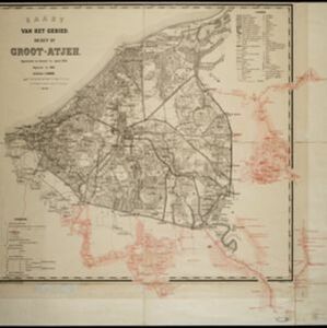
Kaart van het gebied bezet in Groot-Atjeh
1891
Indonesia
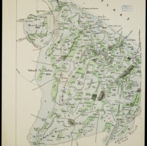
A map of Groot-Atjceh and the city of Kota Radja (modern Banda Aceh) at the northern tip of Sumatra, detailing routes (rivers, roads, railways), crops (rice, banana, sugarcane, betel, reed, alang-alang, bamboo) and land features (forests, wetlands).
- Kampong/Village2
- [remove]Military Fort2
- [remove]Residential Area2
- Cemetery/Columbarium1
- Mosque1
- Public Space1
- Well1
- Scale2
- [remove]Written Note/Details2
- Contour Lines/Elevation1
- Longitude and Latitude1


