Search

Search Results

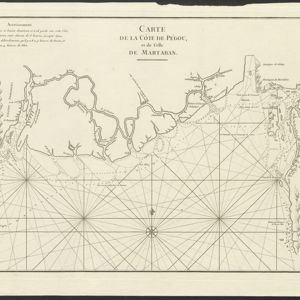
Carte de la Côte de Pégou, et de celle de Martaban

event1775

location_onMyanmar

Navigation map of the coast of the ancient kingdom of Pégou and near the town of Martaban (Mottama), Myanmar. Bathymetry (sea depth), anchor points, notes on currents and obstructions are marked, and there are drawings of side views of coastal hills.
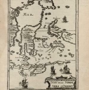
Isles de la Sonde vers l'Orient

event1683

location_onEast Timor, Indonesia, Philippines

French text on the reverse of this map of the eastern Sunda Islands describes the city of Macassar (modern Makassar) on Celebes (Sulawesi, Indonesia). Details include the city’s port, trade and crops, as well as its people and religion.

close

  • Filter from 1683 to 1775

Current results range from 1683 to 1775