Search

Search Results

A map of the East-Indies and the adjacent countries: with the settlements, factories and territories, explaining what belongs to England, Spain, France, Holland, Denmark, Portugal &c.

event1717

location_onBrunei, Cambodia, East Timor, Indonesia, Laos, Malaysia, Myanmar, Philippines, Singapore, Southeast Asia, Thailand, Vietnam

This map showcases the colonial territories of Southeast Asia in the 18th century, with text detailing trading information and the products of each region. There are five inset maps featuring plans of specific trading ports.

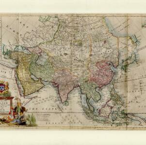
To the Right Honourable William, Lord Cowper, Lord High Chancellor of Great Britain, this map of Asia

event1715

location_onVietnam, Myanmar, Papua New Guinea, Philippines, Singapore, Southeast Asia, Thailand, Malaysia, Laos, Indonesia, East Timor, Cambodia, Brunei

This map is dedicated to William Cowper, whose coat of arms sits atop the cartouche. It features two horses holding a crest with three red martlets (mythical birds used in heraldry). The colourful cartouche also features Asian traders.

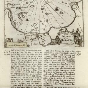
A mapp of the islands before Batavia

event1704

location_onIndonesia

This early 19th century map is from a book titled ‘Mr. John Nieuhoff's Voyages’ in which the author reports on his travels to Southeast Asia, including a detailed description of the important port city of Batavia, as shown on the map.

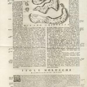
Isole di Banda nelle Molucche

event1692

location_onIndonesia

Map of the Banda Islands from Vicenzo Coronelli's ‘Corso Geografico Universale’, including a volcano on Gunappi (Banda Api), and a military fort on Nera (Banda Neira). Italian text describes the crops, trade, animals and people of the Maluku Islands.

close

  • Filter from 1692 to 1717

Current results range from 1692 to 1717