Search Results
Filter
Commerce
Factory
Remove constraint Commerce: Factory
Cultivation/Extraction
Plantation/Forestry Area
Remove constraint Cultivation/Extraction: Plantation/Forestry Area
Settlement Features
Mosque
Remove constraint Settlement Features: Mosque
Collections
Bodleian Libraries, University of Oxford
Remove constraint Collections: Bodleian Libraries, University of Oxford
2 Results found

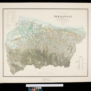
Topographische Kaart der residentie Pekalongan
1892
Indonesia
Topographic map of the residency of Pekalongan (Central Java), divided into regencies (pink borders) and districts (yellow borders). Mountains, forests, settlements, routes, crops—alang-alang, coffee, sugar, rice—factories and warehouses are shown.
- [remove]Factory2
- Warehouse2
- Market1
- Office1
- Shopping Area1
- Crops2
- [remove]Plantation/Forestry Area2
- Agricultural Pond1


