
Search Results


Plan topographique de l'arrondissement de Saigon
1885
Vietnam
Map of the district of Saigon (Ho Chi Minh City, Vietnam), based around the Fleuve Soirap (Soài Rạp River) as it winds its way down to the South China Sea. The city of Saigon is on its banks, surrounded by more rivers, roads, fields and villages.

Topographische Kaart der residentie Probolinggo
1885
Indonesia
Four-sheet topographic map of the residency of Probolinggo (East Java), with an inset map of distances between locations by rail and road, and a signal map. Crops, fishing ponds, sugar factories, and coffee and salt warehouses are shown.

Topographische kaart der residentie Soerabaja
1884
Indonesia
The residency of Soerabaja, East Java, featuring crops (coffee, coconut, sugarcane, rice, alang-alang, bamboo) and fishing ponds. Three inset maps: a triangulation map; a map of distances between settlements by types of transport; Bawean Island.

Topographische kaart der residentie Batavia
c.1882-1883
Indonesia
The residency of Batavia, West Java, featuring plantations (coffee, tea, coconut, cinnamon, nutmeg, sugar); crops (rice, alang-alang, bamboo); fishing ponds; factories, warehouses, shops; routes, administrative borders; mountains, rivers, lakes.


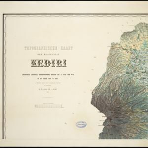
Topographische kaart der residentie Kediri
1879
Indonesia
Four-sheet topographic map of the residency of Kediri (East Java), divided into regencies (pink borders) and districts (yellow borders). Mountains, forests, settlements, routes and crops—sugarcane, alang-alang, rice, coffee, sugar, nutmeg—are shown.

Algemeene kaart van Nederlandsch Indië
1879
Cambodia, Indonesia, Papua New Guinea, East Timor, Southeast Asia, Thailand, Malaysia, Philippines, Laos, Vietnam, Singapore, Brunei, Myanmar
A late 19th century map of the Dutch East Indies on four sheets, detailing maritime routes around the region. There are also inset maps showing railways, rivers, roads, and telegraph systems, as well as individual islands and cities.

Topographische kaart der residentie Madioen
1878
Indonesia
Four-sheet topographic map of the mountainous residency of Madioen (Madiun, East Java), divided into regencies (pink borders) and districts (yellow borders). Crops—sugarcane, alang-alang, rice, coffee—sugar factories and coffee warehouses are shown.


