Search Results

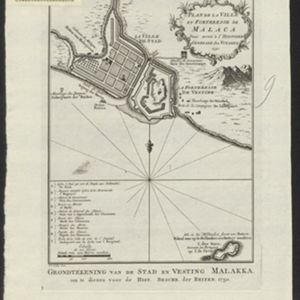
Plan de la ville et forteresse de Malaca = Grondtekening van de Stad en Vesting Malakka
1750
Malaysia
This mid-18th century plan of the city of Malaca (Malacca/Melaka) focuses on the military fort (‘A Famosa [The Famous]’), but also includes two churches, a mosque and a Chinese temple. Two markets are also marked, as is the entrance to the port.

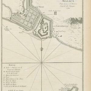
Plan de la ville et forteresse de Malaca: pour servir à l'histoire generale des voyages
1750
Malaysia
This mid-18th century plan of the city of Malaca (Malacca/Melaka) focuses on the military fort (‘A Famosa [The Famous]’), but also includes two churches, a mosque and a Chinese temple. Two markets are also marked, as is the entrance to the port.

Ware affbeeldinge wegens het casteel ende stadt Batavia gelegen opt groot eylant Java anno 1669
1670
Indonesia
A plan of the important port of Batavia (Jakarta), with the fort, river, city streets and fields. Decorative illustrations include ships in the harbour, a view of the city and mountains, and the city’s coat of arms: a lion holding a sword and shield.


