Search Results

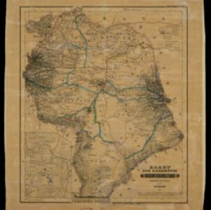
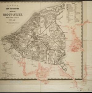
Kaart van het gebied bezet in Groot-Atjeh
1891
Indonesia
A map of Groot-Atjceh and the city of Kota Radja (modern Banda Aceh) at the northern tip of Sumatra, detailing routes (rivers, roads, railways), crops (rice, banana, sugarcane, betel, reed, alang-alang, bamboo) and land features (forests, wetlands).

Algemeene kaart van Nederlandsch Oostindie
c.1839-1855
East Timor, Indonesia, Malaysia, Singapore
This map of the Dutch East Indies is spread over eight sheets, with a hand-drawn cover sheet showing the whole area. There are numerous inset maps of islands, bays, cities etc. Two of the inset maps have a replacement map pasted over them.
- Dutch East Indies9
- Java9
- Batavia8
- Jakarta8
- Java Sea3
- Sumatra3
- Amboina2
- Ambon2
- Archipel van Oranje Nassau2
- Ayer Bangies2
- Banda2
- Banda Islands2
- more Detailed Location »
- [remove]Public Space14
- Residential Area14
- Church13
- Cemetery/Columbarium11
- Hospital10
- Kampong/Village10
- Military Fort9
- Court of Law8
- Palace7
- Post Office6
- Well6
- Jail/Prison5
- Military Barracks5
- Communal Land/Property4
- more Settlement Features »
- [remove]Market14
- Factory8
- Shopping Area8
- Warehouse4
- Office3
- [remove]Path14
- River13
- Road12
- Canal8
- Railway/Tramway7
- Postal Route5
- Bridge4
- Telegraph/Telephone3
- Derfelden van Hinderstein, Gijsbert Franco von2
- Blakelock, D.H.1
- Cronenberg, G.P.F.1
- Dornseiffen, Dr. I.1
- McCallum, Major Henry Edward1
- Ourand, C.H.1
- Stück, E.H.1
- Thuillier, Colonel H.R.1
- more Map Maker »
- Topographische Bureau3
- Homann Heirs2
- Stanford's Geographical Establishment2
- G. Kolff & Co.1
- Julius Bien & Co.1
- Seyffardt's Boekhandel1
- Survey of India Offices, Calcutta1
- Van Haren Noman & Kolff1
- more Printer/Publisher »