Search Results

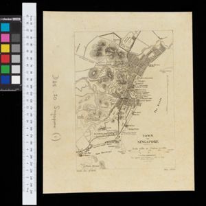
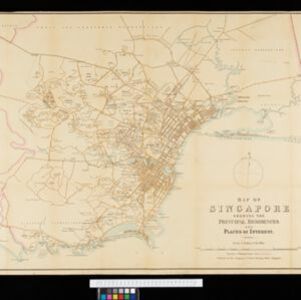
Map of Singapore showing the principal residences and places of interest
1892
Singapore
Map of the city of Singapore, including the central civic/business area around the Singapore River, Fort Canning, Tanjong Pagar dock, and residential areas. The city is surrounded by villages and plantations (pineapple, fruit and vegetable, coconut).

Military cantonments: town and suburbs of Akyab, 1853-54
1866
Myanmar
Plan of British military installations in the port town of Akyab, Burma (Sittwe, Myanmar), featuring piers on the Kolladyne River (Kaladan River), hospitals, a work house, mission house, hotel, bazaar, burial grounds, religious buildings etc.
- Tanjong Pagar4
- Fort Canning3
- Singapore River3
- Singapore Town3
- Johore2
- Kedah2
- Kelantan2
- Luzon2
- Malacca2
- Malay Peninsula2
- Manila2
- Mindoro2
- more Detailed Location »
- [remove]Cemetery/Columbarium13
- Church13
- Residential Area13
- Hospital12
- Public Space10
- Court of Law9
- Jail/Prison9
- Kampong/Village9
- Police Station9
- Military Barracks7
- Mosque7
- Temple5
- Military Fort3
- Palace3
- more Settlement Features »
- [remove]Market13
- Shopping Area9
- Factory7
- Warehouse6
- Office4
- Akber, Golam1
- Blakelock, D.H.1
- Dayot1
- Jackson, Lieutenant Philip1
- Jekyll, Captain1
- McCallum, Major Henry Edward1
- Ourand, C.H.1
- Porteaus, A.1
- more Map Maker »
- Stanford's Geographical Establishment3
- Intelligence Branch, War Office2
- Henry Colburn1
- Intelligence Division, War Office1
- Julius Bien & Co.1
- Philippines Company1
- Royal Asiatic Society1
- School of Military Engineering, Chatham1
- more Printer/Publisher »