Search

Search Results

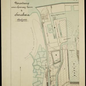
Voorontwerp eener spoorweghaven te Soerabaia

event1898

location_onIndonesia

Spread over four sheets, this is a detailed hand-drawn plan for railway and tramway lines at the port of Soerabaia (Surabaya, East Java). It includes a railway station, commercial areas, housing, customs, warehouses, offices and government buildings.

[Batavia en omgeving]

event1898

location_onIndonesia

Four sheets from a larger series of maps, showing the city of Batavia (Jakarta, Java). The port, railway network and city centre are shown in great detail. To the west and south of the centre, there are villages, rice paddies, fields and wetlands.

Voorontwerp eener spoorweghaven te Soerabaia

event1897

location_onIndonesia

Spread over four sheets, this is a detailed hand-drawn plan for railway and tramway lines at the port of Soerabaia (Surabaya, East Java). It includes a railway station, commercial areas, housing, customs, warehouses, offices and government buildings.

Kaart van de residentie Oostkust van Sumatra

event1896

location_onIndonesia

Detailed topographical map of the east coast of Sumatra, spread over 36 sheets. The area’s farms are listed and shown on the map within yellow borders, with types of crop grown. There is a detailed plan of Medan, and five inset maps of other towns.

Kaart van de Hoofdplaats Padang

event1896

location_onIndonesia

Map of the city of Padang, Sumatra, featuring roads, religious and military buildings, markets, warehouses and factories, and a railway station. Surrounding areas have villages and fields of rice, nutmeg, coconut, bamboo, alang-alang, sugarcane.

Kaart van de residentie Oostkust van Sumatra

event1889

location_onIndonesia

Detailed topographical map of the east coast of Sumatra, spread over 34 sheets. The area’s farms are listed and shown on the map, with types of crop grown. With five inset maps of individual towns. Two sheets and the cover sheet are missing.

Kaart van de residentie Oostkust van Sumatra

event1889

location_onIndonesia

Detailed topographical map of the east coast of Sumatra, spread over 36 sheets plus a cover sheet of the whole area. Mountains and forests dominate, with villages, routes and administrative borders shown. With five inset maps of individual towns.

close

  • Filter from 1889 to 1898

Current results range from 1889 to 1898