Search Results

Algemeene kaart van Nederlandsch Oostindie
c.1839-1855
East Timor, Indonesia, Malaysia, Singapore
This map of the Dutch East Indies is spread over eight sheets, with a hand-drawn cover sheet showing the whole area. There are numerous inset maps of islands, bays, cities etc. Two of the inset maps have a replacement map pasted over them.
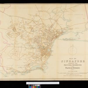
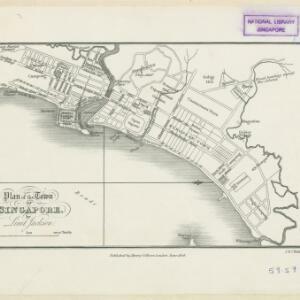
Map of Singapore showing the principal residences and places of interest
1892
Singapore
Map of the city of Singapore, including the central civic/business area around the Singapore River, Fort Canning, Tanjong Pagar dock, and residential areas. The city is surrounded by villages and plantations (pineapple, fruit and vegetable, coconut).
- Java15
- Batavia11
- Dutch East Indies11
- Jakarta11
- Malay Peninsula4
- Soerabaja4
- Surabaya4
- Fort Canning3
- Java Sea3
- Singapore River3
- Singapore Town3
- Tanjong Pagar3
- more Detailed Location »
- [remove]Public Space22
- Residential Area22
- Church19
- Cemetery/Columbarium16
- Hospital16
- Kampong/Village16
- Military Fort13
- Military Barracks11
- Police Station10
- Court of Law9
- Jail/Prison8
- Mosque7
- Temple5
- Post Office4
- more Settlement Features »
- [remove]Shopping Area22
- Market19
- Warehouse16
- Factory9
- Office8
- Derfelden van Hinderstein, Gijsbert Franco von2
- Bellin, Jacques Nicolas1
- Cronenberg, G.P.F.1
- Dornseiffen, Dr. I.1
- Fromp, J.1
- Jackson, Lieutenant Philip1
- Jongh, W. de1
- Krevelt, Abraham van1
- more Map Maker »
- Stanford's Geographical Establishment3
- G. Kolff & Co.2
- Intelligence Branch, War Office2
- Topographische Bureau2
- Henry Colburn1
- Intelligence Division, War Office1
- Petrus (Peter) Conradi1
- Royal Asiatic Society1
- more Printer/Publisher »