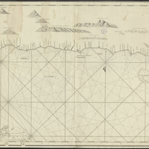
Chart of the North Coast of Java from Samarang to Batavia
1740
Indonesia
This map uses a variety of methods to aid navigation, including a rhumbline network (a web of lines to help plot routes). The numbers on the sea surface indicate depth (bathymetry), and the drawings of mountains (elevations) were used as landmarks.


