Search

Search Results

Royaume de Siam, avec les Royaumes qui luy sont Tributaires, et les Isles de Sumatra, Andemaon etc.

event1742

location_onBrunei, Cambodia, Indonesia, Laos, Malaysia, Myanmar, Singapore, Thailand, Vietnam

Map marking the routes through maritime Southeast Asia of two delegations: a French delegation from Brest, France to Siam in 1685; and a Siamese delegation from Siam to Brest in 1686. A note next to Aceh records a sea battle against Portugal in 1616.

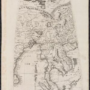
[Globe gore covering Asia]

eventc.1693-1707

location_onMalaysia, Cambodia, Indonesia, Laos, Myanmar, Singapore, Thailand, Vietnam

On this map, ‘Lago di Chiamay’, one of number of mythical lakes once thought to exist in southern China, feeds five rivers—labelled ‘Menam’, ‘Pegu’ ‘Maraban’, ‘Cosmin’ and ‘Caor’—which flow south through mainland Southeast Asia.

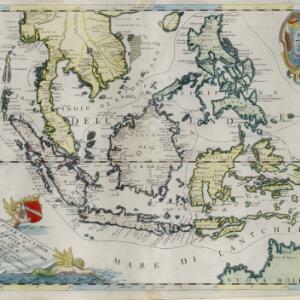
Isole dell'Indie divise in Filippine, Molucche e della Sonda

eventc.1691-1696

location_onBrunei, Cambodia, East Timor, Indonesia, Laos, Malaysia, Myanmar, Philippines, Singapore, Southeast Asia, Thailand, Vietnam

Dotted lines and colours divide maritime Southeast Asia into three regions on this map: the Philippine archipelago, Maluku Islands and Sunda Islands. The cartouche features cherub mermaids carrying a banner and shield.

Isole dell'Indie divise in Filippine, Molucche e della Sonda

event1680

location_onBrunei, Cambodia, East Timor, Indonesia, Malaysia, Laos, Myanmar, Philippines, Singapore, Southeast Asia, Thailand, Vietnam

Dotted lines and colours divide maritime Southeast Asia into three regions on this map: the Philippine archipelago, Maluku Islands and Sunda Islands. The cartouche features cherub mermaids, and a map of mainland Southeast Asia is on the reverse.

close