Search Results
Filter
Map Maker
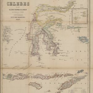
Geest, Evert de
Remove constraint Map Maker: Geest, Evert de
Printer/Publisher
Seyffardt's Boekhandel
Remove constraint Printer/Publisher: Seyffardt's Boekhandel
Political Regions
District/Administrative Border
Remove constraint Political Regions: District/Administrative Border