
Search Results
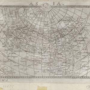
Asia: ex magna orbis terre descriptione Gerardi Mercatoris desumpta, studio et industria G.M. Iunioris
c.1609-1619
Brunei, Cambodia, East Timor, Indonesia, Laos, Malaysia, Myanmar, Philippines, Singapore, Southeast Asia, Thailand, Vietnam
Although quite detailed for an early 17th century map of Asia, there are some inaccuracies in the representation of the islands of Southeast Asia, particularly Java (labelled 'Iaua maior'), Borneo (Burne), Sulawesi (Celebes) and the Maluku Islands.
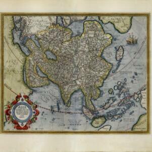
Asia: ex magna orbis terre descriptione Gerardi Mercatoris desumpta, studio et industria G.M. Iunioris
c.1613-1630
Brunei, Cambodia, East Timor, Indonesia, Laos, Malaysia, Myanmar, Philippines, Singapore, Southeast Asia, Thailand, Vietnam
Although quite detailed for an early 17th century map of Asia, there are some inaccuracies in the representation of the islands of Southeast Asia, particularly Java (labelled 'Iaua maior'), Borneo (Burne), Sulawesi (Celebes) and the Maluku Islands.

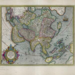
Asia: ex magna orbis terre descriptione Gerardi Mercatoris desumpta, studio & industria G.M. Iunioris
1630
Brunei, Cambodia, East Timor, Indonesia, Laos, Malaysia, Myanmar, Philippines, Singapore, Southeast Asia, Thailand, Vietnam
Originally published in Gerardus Mercator's ‘Atlas Sive Cosmographicae Meditationes de Fabrica Mundi et Fabricati Figura’ (1595), the title of which was the first use of the word ‘atlas’ to refer to a collection of maps. This is a 1630 reprint.

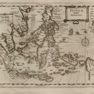
Insulæ Indiæ orientalis
1630
Brunei, Cambodia, East Timor, Indonesia, Laos, Malaysia, Myanmar, Philippines, Singapore, Southeast Asia, Thailand, Vietnam
The southern coast of Java ('Iava Maior') on this map is represented by a dotted line, indicating that the exact coastline was unknown at this time. French text on the reverse describes the geography, crops, animals etc. of the Maluku Islands.
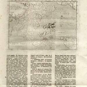
Insulæ Indiæ orientalis
1690
Brunei, Cambodia, East Timor, Indonesia, Laos, Malaysia, Myanmar, Philippines, Singapore, Southeast Asia, Thailand, Vietnam
The southern coast of Java ('Iava Maior') on this map is represented by a dotted line, indicating that the exact coastline was unknown at this time. Italian text on the reverse describes the Maluku Islands including Ambon, Banda and Ternate.
India orientalis
1713
Brunei, Cambodia, East Timor, Indonesia, Laos, Malaysia, Myanmar, Philippines, Singapore, Southeast Asia, Thailand, Vietnam
This map is from ‘Universus terrarum orbis scriptorum calamo delineatus’ by Alphonsus Lasor a Varea (pseudonym of Raffaello Savonarola (1680–1748), a monk who worked in the monastery library in Padua).


