Search

Search Results

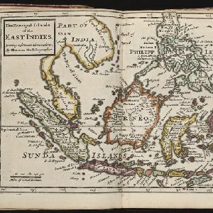
The principal islands of the East Indies, according to ye newest observations

event1732

location_onBrunei, Cambodia, East Timor, Indonesia, Laos, Malaysia, Myanmar, Philippines, Singapore, Southeast Asia, Thailand, Vietnam

A map of Southeast Asia by the London-based cartographer Herman Moll (1654?–1732) with hand-coloured regional borders. The north coast of Borneo is labelled ‘A Desart [desert] Coast’, while the south is labelled ‘Pepper Country’.

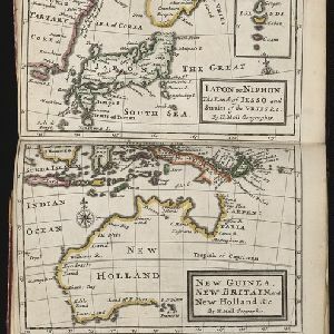
Iapon or Niphon the land of Iesso and Straits of the Vries / New Guinea, New Britain, and New Holland &c.

event1732

location_onEast Timor, Indonesia, Papua New Guinea

The London-based cartographer Herman Moll (1654?–1732) created this map of New Guinea and the neighbouring islands of maritime Southeast Asia. It shows that in the 1730s, the details of New Guinea and Australia (‘New Holland’) were uncertain.

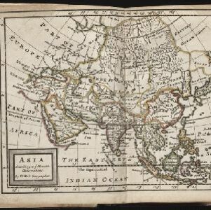
Asia according to ye newest observations

eventc.1670-1732

location_onBrunei, Cambodia, East Timor, Indonesia, Laos, Malaysia, Myanmar, Papua New Guinea, Philippines, Singapore, Southeast Asia, Thailand, Vietnam

A map of Asia by the London-based cartographer Herman Moll (1654?–1732) with colour-coded regional borders. In Southeast Asia, each major land mass or island has its own coloured border.

close

  • Filter from 1670 to 1732

Current results range from 1670 to 1732