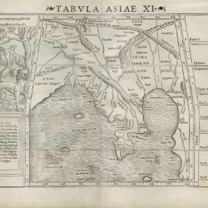
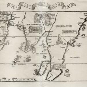
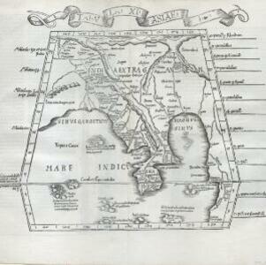
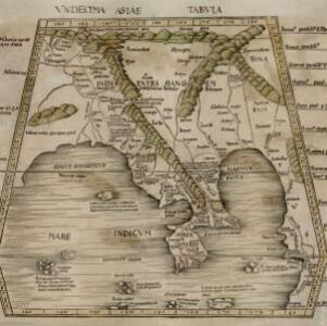
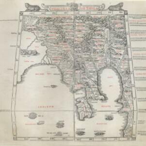
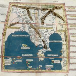
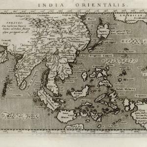
Search

Search Results

India orientalis

eventc.1597-1617

location_onBrunei, Cambodia, East Timor, Indonesia, Laos, Malaysia, Myanmar, Philippines, Singapore, Southeast Asia, Thailand, Vietnam

Latin text written on New Guinea explains that it is uncertain whether it is an island or part of ‘Australis’ (‘southern land’) a name that was used for a continent thought to exist in the region (and after which Australia was eventually named).

Tabvla Asiae XI

event1574

location_onCambodia, Indonesia, Malaysia, Laos, Myanmar, Singapore, Thailand, Vietnam, Southeast Asia

Mid-16th century map by Girolamo Ruscelli, based on the work of 2nd century geographer Ptolemy. It is difficult to pinpoint exact locations, but the Malay Peninsula is recognisable. Italian text on the reverse describes the region.

Tabvla Asiae XI

event1561

location_onCambodia, Indonesia, Malaysia, Laos, Myanmar, Singapore, Thailand, Vietnam, Southeast Asia

Mid-16th century map by Girolamo Ruscelli, based on the work of 2nd century geographer Ptolemy. It is difficult to pinpoint exact locations, but the Malay Peninsula is recognisable. Italian text on the reverse describes the region.

Tabvla Asiae XI

eventc.1542-1552

location_onCambodia, Indonesia, Malaysia, Myanmar, Singapore, Thailand, Vietnam, Southeast Asia

Early map by Sebastian Münster, based on the work of 2nd century geographer Ptolemy. The Malay Peninsula—labelled ‘Aurea Chersonesus [Golden Chersonese]’—is recognisable. An illustration shows the local animals: a tiger, cockerels and a white parrot.

Tabv moder Indiae

event1535

location_onCambodia, Indonesia, Malaysia, Myanmar, Thailand, Vietnam

Early map of Asia, with the islands of Taprobana (Sumatra) to the west of the Malay Peninsula, and Timonia (Tioman) to the east. Text gives details of local economies: sandalwood on Tioman, and silver and silk at Lamai near Mallaqua (Malacca).

Tabvla XI Asiae

event1522

location_onCambodia, Indonesia, Laos, Malaysia, Myanmar, Singapore, Thailand, Vietnam, Southeast Asia

Early map by Lorenz Fries, based on the work of 2nd century geographer Ptolemy. The Malay Peninsula—labelled ‘Aurea Chersone [Golden Chersonese]’—is recognisable. A drawing on the reverse features cannibals with dog’s heads chopping up human bodies.

Vndecima Asiae Tabvla

event1513

location_onCambodia, Laos, Malaysia, Myanmar, Singapore, Thailand, Vietnam

Based on the work of 2nd century geographer Ptolemy, this map by Martin Waldseemüller has Latin inscriptions. The Malay Peninsula is labelled ‘Aurea Chersones [Golden Chersonese]’.

Vndecima Asiae Tabvla

event1511

location_onCambodia, Laos, Malaysia, Myanmar, Singapore, Thailand, Vietnam

Based on the work of 2nd century geographer Ptolemy, Bernardo Silvani’s woodcut map is innovative in its use of two colours: a black background with important text added in red. The Malay Peninsula is labelled ‘Aurea Chersonesus [Golden Chersonese]’.

Vndecima Asiae Tabvla

event1486

location_onCambodia, Laos, Malaysia, Myanmar, Singapore, Thailand, Vietnam

Based on the work of 2nd century geographer Ptolemy, this colourful map has Latin inscriptions including ‘Aurea Regio [Kingdom of Gold]’ and ‘Regio Argenteo [Kingdom of Silver]’. The Malay Peninsula is labelled ‘Curra Cherlon [Golden Chersonese]’.

Vndecima Asiae Tabvla

event1478

location_onCambodia, Laos, Malaysia, Myanmar, Singapore, Thailand, Vietnam

Based on the work of 2nd century geographer Ptolemy, this map has Latin inscriptions, including mentions of a mythical race of cannibals (‘Anthropophagi’) and hippopotamuses. The Malay Peninsula is labelled ‘Aurea Chersonesus [Golden Chersonese]’.

close

  • Filter from 1478 to 1597

Current results range from 1478 to 1597