Search Results

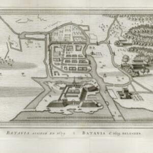
Batavia assiegé en 1629 = Batavia A.o 1629 belegerd
c.1772-1780
Indonesia
This unusual map of Batavia in the late 18th century shows the port city as seen when approaching from the sea. The castle is depicted prominently as a three-dimensional drawing, with the rest of the city behind more flat like a plan.
- Bellin, Jacques Nicolas2
- [remove]Schley, Jacobus van der2
- Changuion, Daniel Jean1
- Harrevelt, Evert van1
- Prévost, Abbé1
- [remove]Amsterdam2


