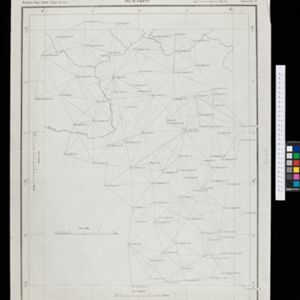
Chart of triangulation: No.21 Party, Northern Shan States (Upper Burma)
event1899
location_onMyanmar
A triangulation map of part of Upper Burma (Myanmar), showing dozens of locations joined with straight lines to create a triangulation network.
India
event1898
location_onIndonesia, Malaysia, Myanmar, Thailand
British Burma is coloured pink on this six-sheet map of India. Mountains are represented by hachures—short lines/dashes that give a sense of the shape and steepness of terrain—and settlements, railways, roads, rivers and lighthouses are marked.