Six-sheet topographic map of the residency of Cheribon (Cirebon, West Java), with an inset of a geodesic triangle grid. Administrative districts, crops—rice, alang-alang, sugarcane, sugar, coffee, tea—and indigo plant mills are shown.
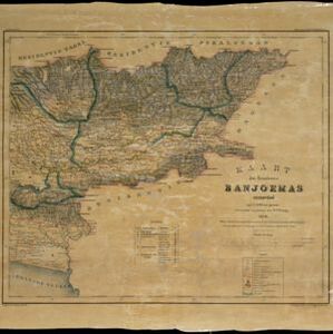
Kaart der residentie Banjoemas
event1870
location_onIndonesia
The residency of Banyumas (‘Residentie Banjoemas’) in Central Java is shown divided into regencies (yellow borders) and districts (blue borders) on this map. Cities, towns and villages are marked, as are roads, rivers, paths and postal routes.