
Search Results
8 Results found

Kaart van de Nederlandsche bezittingen in Oost-Indië
1840
Brunei, East Timor, Indonesia, Malaysia, Philippines, Singapore
This map shows the Dutch colonial possessions in the East Indies in the mid-19th century. The text provides great detail about the people, religion, crops, animals, geography and administration of the Dutch East Indies.

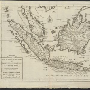
Nuove carte delle Isole di Sunda come Borneo, Sumatra e Java Grande &c.
1740
Brunei, Cambodia, Indonesia, Malaysia, Singapore, Thailand
Based on a Dutch map of the Sunda Islands, with the text changed to Italian. Some Dutch remains e.g. a label on Borneo: ‘Beajous Afgoden dienars bewonende het middelste gedeelte vant Eilland [Beajous idolaters inhabit the middle part of the Island]’.

Nuove carte delle Isole di Sunda come Borneo, Sumatra e Java Grande &c.
c.1740-1784
Brunei, Cambodia, Indonesia, Malaysia, Singapore, Thailand
Based on a Dutch map of the Sunda Islands, with the text changed to Italian. Some Dutch remains e.g. a label on Borneo: ‘Beajous Afgoden dienars bewonende het middelste gedeelte vant Eilland [Beajous idolaters inhabit the middle part of the Island]’.
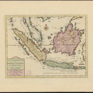
Nieuwe kaart van de Sundasche eilanden als Borneo, Sumatra en Groot Iava &c.
c.1731-1769
Brunei, Cambodia, Indonesia, Malaysia, Singapore, Thailand
On this mid-18th century map of the Sunda Islands, a label on the island of Borneo states ‘Beajous Afgoden dienars bewonende het middelste gedeelte vant Eilland [Beajous idolaters inhabit the middle part of the Island]’.


