Search

Search Results

Burma

event1899

location_onMyanmar

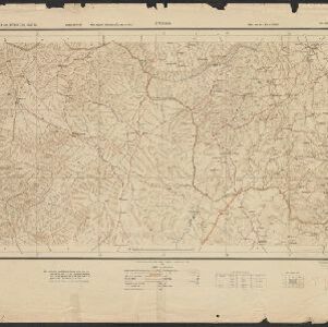
A large-scale topographical map of the states of Hsipaw, Lawksawk and Mongkung, within the Shan State of Burma (Myanmar). Elevation is indicated by contour lines, and travel and trade routes, villages, areas of cultivation and markets are also shown.

Sumatra

eventc.1899-1902

location_onIndonesia

Eight sheets from a large-scale detailed topographic map of Sumatra (many other sheets are missing). Includes crops (rice, coconut, coffee, banana, sugar, gambier, cinnamon, bamboo, alang-alang, arenga palm), routes (railways, roads), settlements.

Kaart van de Hoofdplaats Padang

event1896

location_onIndonesia

Map of the city of Padang, Sumatra, featuring roads, religious and military buildings, markets, warehouses and factories, and a railway station. Surrounding areas have villages and fields of rice, nutmeg, coconut, bamboo, alang-alang, sugarcane.

Plan of the town and suburbs of Rangoon

eventc.1895-1897

location_onMyanmar

Detailed plan of the city of Rangoon (Yangon, Myanmar) with commercial, religious, government and military buildings, surrounded by lakes, fields of crops and villages. Someone has drawn details on the map of areas that have undergone ‘levelling’.

City of Mandalay and environs

event1894

location_onMyanmar

Map of the Burmese city of Mandalay on the Irrawaddy River. The city has a grid of roads and buildings, dominated by Fort Dufferin (formerly Mandalay Palace). The surrounding country has villages, crops, agricultural ponds and irrigation channels.

Military cantonments: town and suburbs of Akyab, 1853-54

event1866

location_onMyanmar

Plan of British military installations in the port town of Akyab, Burma (Sittwe, Myanmar), featuring piers on the Kolladyne River (Kaladan River), hospitals, a work house, mission house, hotel, bazaar, burial grounds, religious buildings etc.

close