Search

Search Results

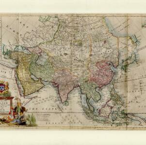
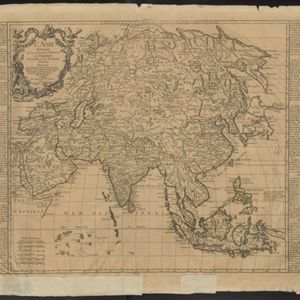
L'Asie Divisée en ses Grandes Régions et Empires: Subdivisée en ses Principaux Estats

event1759

location_onBrunei, Cambodia, East Timor, Indonesia, Laos, Malaysia, Myanmar, Philippines, Singapore, Southeast Asia, Thailand, Vietnam

Map of the regions, empires and states of Asia. Extensive notes cover religion (people of mainland Southeast Asia are idolaters), colonialism (Dutch and Portuguese rule in Malacca and the Sunda Islands) and the spice trade of the Maluku Islands.

A new and accurate map of the East India Islands: laid down according to the latest discoveries, and agreeable to the most approved maps & charts

event1750

location_onBrunei, Cambodia, East Timor, Indonesia, Laos, Malaysia, Myanmar, Vietnam, Thailand, Southeast Asia, Singapore, Philippines

This mid-18th century map of Southeast Asia includes written notes on goods produced and traded, geographical features, and wild animals found in each part of the region. The cartouche features a drawing of Asia with people, fields and palm trees.

A new and accurate map of the East India Islands: laid down according to the latest discoveries, and agreeable to the most approved maps & charts

eventc.1744-1747

location_onBrunei, Cambodia, East Timor, Indonesia, Laos, Malaysia, Myanmar, Philippines, Singapore, Southeast Asia, Thailand, Vietnam

This mid-18th century map of Southeast Asia includes written notes on goods produced and traded, geographical features, and wild animals found in each part of the region.

To the Right Honourable William, Lord Cowper, Lord High Chancellor of Great Britain, this map of Asia

event1720

location_onBrunei, Cambodia, East Timor, Indonesia, Laos, Malaysia, Myanmar, Papua New Guinea, Philippines, Singapore, Southeast Asia, Thailand, Vietnam

Map dedicated to William Cowper, whose coat of arms sits atop the cartouche. It features two horses holding a crest with three martlets (mythical birds used in heraldry). The cartouche also features Asian traders. Monsoons are marked on the map.

A map of the East-Indies and the adjacent countries: with the settlements, factories and territories, explaning what belongs to England, Spain, France, Holland, Denmark, Portugal &c.

event1720

location_onBrunei, Cambodia, East Timor, Indonesia, Laos, Malaysia, Myanmar, Philippines, Vietnam, Thailand, Southeast Asia, Singapore

This map showcases the colonial territories of Southeast Asia in the 18th century, with text detailing trading information and the products of each region. There are five inset maps featuring plans of specific trading ports.

To the Right Honourable William, Lord Cowper, Lord High Chancellor of Great Britain, this map of Asia

eventc.1715

location_onVietnam, Myanmar, Papua New Guinea, Philippines, Singapore, Southeast Asia, Thailand, Malaysia, Laos, Indonesia, East Timor, Cambodia, Brunei

The arrows on this map show the direction of the seasonal monsoons: each arrow has a label, indicating the month. The northeast coast of Borneo is labelled ‘A Desart [desert/deserted?] Coast’, while the south is labelled ‘Pepper Country’.

To the Right Honourable William, Lord Cowper, Lord High Chancellor of Great Britain, this map of Asia

event1715

location_onVietnam, Myanmar, Papua New Guinea, Philippines, Singapore, Southeast Asia, Thailand, Malaysia, Laos, Indonesia, East Timor, Cambodia, Brunei

This map is dedicated to William Cowper, whose coat of arms sits atop the cartouche. It features two horses holding a crest with three red martlets (mythical birds used in heraldry). The colourful cartouche also features Asian traders.

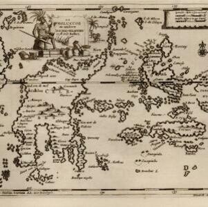
De Moluccos en andere Speceri-Eilanden in d'Oost-Indien

event1714

location_onIndonesia

Map of the ‘Spice Islands’ of maritime Southeast Asia, including the Maluku Islands. It is decorated with a drawing of an Asian man holding a large bird and a spear, and surrounded by baskets and boxes of goods of the spice trade.

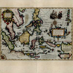
Insulæ Indiæ orientalis præcipuæ: in quibus Moluccæ celeberrimæ sunt

event1623

location_onBrunei, Cambodia, East Timor, Indonesia, Laos, Malaysia, Myanmar, Philippines, Singapore, Southeast Asia, Thailand, Vietnam

On the right of this map, Latin text held within an elaborate border notes that five of the Maluku Islands are located nearby—Ternate, Tidore, Moti, Makian and Bacan—which trade spices including clove, cinnamon, nutmeg and ginger to the world.

Insulæ Indiæ orientalis præcipuæ: in quibus Moluccæ celeberrimæ sunt

event1606

location_onBrunei, Cambodia, East Timor, Indonesia, Laos, Malaysia, Myanmar, Philippines, Singapore, Southeast Asia, Thailand, Vietnam

On the right of this map, Latin text held within an elaborate border notes that five of the Maluku Islands are located nearby—Ternate, Tidore, Moti, Makian and Bacan—which trade spices including clove, cinnamon, nutmeg and ginger to the world.

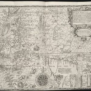
Insvlae Molvccae

event1598

location_onBrunei, Cambodia, East Timor, Indonesia, Laos, Malaysia, Papua New Guinea, Philippines, Singapore, Southeast Asia, Thailand, Vietnam

A map featuring drawings of plants used to make spices in the Moluccas or Spice Islands: Nux Myristica (nutmeg), Cariophilorum arbor (cloves), Santalum flavum (yellow sandalwood), Santalum rubrum (red sandalwood), Santalum album (Indian sandalwood).

close