Search

Search Results

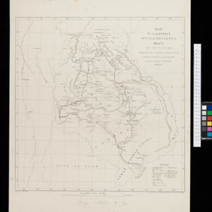
Map to illustrate Mr. W.R.D. Beckett's route, Novr. 1891-April 1892

event1893

location_onVietnam, Thailand, Cambodia, Laos

The route of W.R.D. Beckett between Bangkok and Saigon, partly along the Mekong River, is marked on this map, along with trade routes, police posts, mines (copper, iron, gold), and products (the spice cardamom, and resin benzoin (‘Gumbenjamin’)).

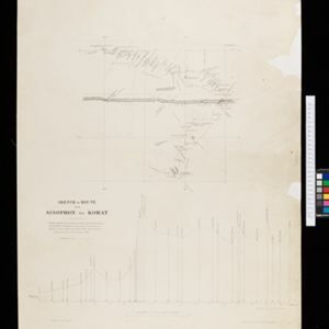
Sketch of route from Sisophon to Korat / Sketch of route from Korat to Nongkhai

event1893

location_onCambodia, Thailand

Routes of W.R.D. Beckett between Sisophon (Cambodia) and Korat, and Korat and Nongkhai (both Thailand) are marked on these two maps, with lacquer trees, paddy fields, bog iron, salt fields shown. The heights of locations along the route are recorded.

Map to illustrate the Siamese question: showing the present limits of French claims, and the additional territory now demanded

event1893

location_onCambodia, Laos, Malaysia, Myanmar, Thailand, Vietnam

Map highlighting areas of eastern Siam (Thailand) claimed by France. Notes describe Siam’s geography, government, population, military and trade (rice, teak, pepper, bullocks, fish, hides, tin, cardamom, tin), including trading partners by tonnage.

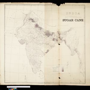
India: Sugar cane

event1893

location_onMyanmar

On this map of India and Burma (Myanmar), shading indicates what percentage of each province is used for the cultivating sugarcane. Part of a series of maps of the same area showing different crops (others include cotton and rice).

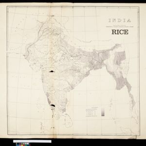
India: Rice

event1893

location_onMyanmar

On this map of India and Burma (Myanmar), shading indicates what percentage of each province is used for the cultivating rice. Part of a series of maps of the same area showing different crops (others include cotton and sugarcane).

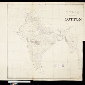
India: Cotton

event1893

location_onMyanmar

On this map of India and Burma (Myanmar), shading indicates what percentage of each province is used for the cultivating cotton. Part of a series of maps of the same area showing different crops (others include rice and sugarcane).

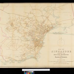
Map of Singapore showing the principal residences and places of interest

event1892

location_onSingapore

Map of the city of Singapore, including the central civic/business area around the Singapore River, Fort Canning, Tanjong Pagar dock, and residential areas. The city is surrounded by villages and plantations (pineapple, fruit and vegetable, coconut).

British Burma, Pegu division: With additions to railways up to 1891

event1891

location_onMyanmar

Topographical map of the Pegu Division of British Burma (Myanmar), spread over four sheets. In addition to mountains, forests, rivers and wetlands, rice fields, routes (road, railway, path, telegraph), villages and pagodas are marked.

Rough Sketch of 200 miles of the western portion of British New Guinea, including rivers

event1890

location_onPapua New Guinea

Map of British New Guinea with notes on the terrain (‘Low country’), vegetation (‘Mangrove, Nipa and Fan Palms’), crops (‘Small plantations Sugar cane & Taro’), coastal features (‘Coral and Sand flats) and people (‘Friendly tribe’, ‘Dariamo Tribe’).

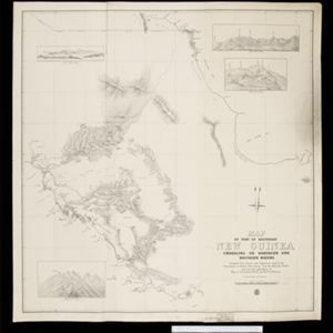
Map of part of south-east New Guinea embracing its northern and southern waters

event1889

location_onPapua New Guinea

This map focuses on the southern coast including the capital Port Moresby, with the northern regions left mostly blank. There are four inset drawings of side views of mountains (elevations), and the border with German New Guinea is marked.

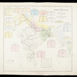
The external trade routes of India: with tables showing the amount and value of the principal exports and imports of the chief Indian sea ports and frontier states

event1886

location_onMyanmar, Thailand

This map of the trade routes of India includes Burma (Myanmar) and part of Siam (Thailand). The Rangoon and Irrawaddy Valley State Railway is marked. There are tables showing the values of imports and exports for each area, listed by produce type.

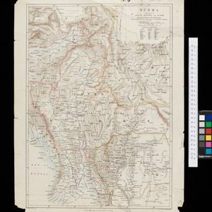
Burma: with parts of India, China, and Siam

event1886

location_onMyanmar, Laos, Thailand

Map of Burma labelled with indigenous peoples (uppercase red text) and products (salt, copper, tea, rubies, coal, rubber, petroleum, marble, jade, silver) of each area. It also marks two journeys by the explorer J. Annan Bryce, and proposed railways.

close