Search

Search Results

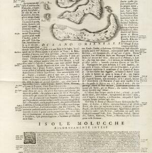
Isole di Banda nelle Molucche

event1692

location_onIndonesia

Map of the Banda Islands from Vicenzo Coronelli's ‘Corso Geografico Universale’, including a volcano on Gunappi (Banda Api), and a military fort on Nera (Banda Neira). Italian text describes the crops, trade, animals and people of the Maluku Islands.

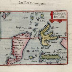
Moluccæ insulæ

event1602

location_onIndonesia

This early 17th century map features Gilolo (Halmahera) and Seram, as well as Celebes (Sulawesi). French text on the reverse describes the ‘Isles Molucques’ (Maluku Islands), including trade in nutmeg, mace, aloe, cinnamon, ginger, pepper and cloves.

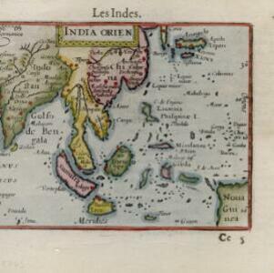
India orien

event1600

location_onBrunei, Cambodia, East Timor, Indonesia, Laos, Malaysia, Myanmar, Philippines, Singapore, Southeast Asia, Thailand, Vietnam

Early 17th century map of Asia, with annotations in Latin naming the major countries, islands and cities. Maritime Southeast Asia is shown as an archipelago of many small islands. French text on the reverse describes crops and animals of the region.

close

  • Filter from 1600 to 1692

Current results range from 1600 to 1692