
Search Results


India orien
1600
Brunei, Cambodia, East Timor, Indonesia, Laos, Malaysia, Myanmar, Philippines, Singapore, Southeast Asia, Thailand, Vietnam
Early 17th century map of Asia, with annotations in Latin naming the major countries, islands and cities. Maritime Southeast Asia is shown as an archipelago of many small islands. French text on the reverse describes crops and animals of the region.

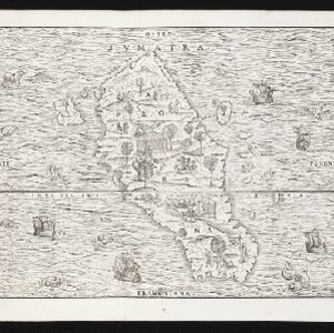
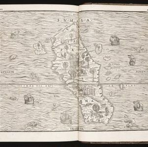
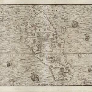
India quae Orientalis dicitur, et insvlae adiacentes
c.1645-1658
Brunei, Cambodia, East Timor, Indonesia, Laos, Malaysia, Myanmar, Philippines, Singapore, Southeast Asia, Thailand, Vietnam
German text on the reverse of this map describes the populations, crops, trade etc. of Sumatra, Borneo, Philippines, and Banda Islands. There are drawings of sailing ships, and the map is dedicated to the Dutch merchant Christophoro Thisio.

Oost Indien
1668
Brunei, Cambodia, East Timor, Indonesia, Laos, Malaysia, Myanmar, Philippines, Singapore, Southeast Asia, Thailand, Vietnam
Map of Asia illustrated with four large allegorical drawings representing the Dutch East India Company, by the Dutch Baroque artist Romeyn de Hooghe. Includes scenes of Asian merchants, the capturing of crocodiles and elephants, and mythology.


Nova tabvla India Orientalis
c.1702-1705
Brunei, Cambodia, East Timor, Indonesia, Laos, Malaysia, Myanmar, Philippines, Singapore, Southeast Asia, Thailand, Vietnam
An early 18th century map of the Indian Ocean, illustrated with a drawing of Asian merchants riding an elephant and using a camel to transport their goods. Other men use bows and arrows to hunt ostriches. Ships are also shown sailing on the ocean.

Insulae Iavae pars Occidentalis
c.1710-1719
Indonesia
A map of Java with mountains, jungles, animals and crops. Bathymetry (sea depth) is marked, including on an inset map of Batavia harbour. Illustrations include Batavia Castle, and a lion—representing Belgium—receiving tribute and enslaving locals.

Orientaliora Indiarum Orientalium cum insulis adjacentibus à promontorio C. Comorin ad Iapan = Pascaert van t'Ooster gedeelte van Oost Indien van C. Comorin tot Iapan
1715
Brunei, Cambodia, East Timor, Indonesia, Laos, Malaysia, Myanmar, Philippines, Singapore, Southeast Asia, Thailand, Vietnam
The cartouche on this early 18th century navigation map features the title in Latin and Dutch, as well as a wealth of detailed drawings illustrating the region’s trade: Asian merchants, their goods and animals, and two female European customers.
- Filter from 1565 to 1759
- [remove]Domesticated Animals30
- Crops23
- Plantation/Forestry Area23
- Mining8
- Fishing5
- [remove]Wild Animals30
- Mountain/Volcano20
- Jungle/Wooded Area13
- Wetlands6


