Search

Search Results

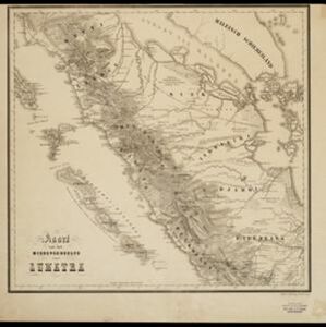
Kaart van het middengedeelte van Sumatra

event1890

location_onIndonesia

Details of each area’s resources are printed on this map of Sumatra: rattan, coffee, pepper, Chinese cinnamon, tobacco, resins, camphor, cotton, coal, gold, lumber, elephants, horses, as well as the locals’ ethnicity (Malays, Javanese, Acehnese).

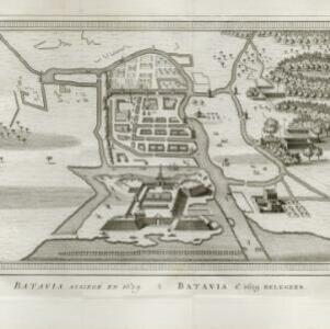
Batavia assiegé en 1629 = Batavia A.o 1629 belegerd

eventc.1772-1780

location_onIndonesia

This unusual map of Batavia in the late 18th century shows the port city as seen when approaching from the sea. The castle is depicted prominently as a three-dimensional drawing, with the rest of the city behind more flat like a plan.

Judia

event1729

location_onThailand

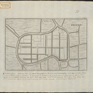
Map of the rivers, roads and canals of Judia (city of Ayutthaya). The legend includes a palace, elephant enclosures, Archbishop’s church and palace. Outside are residential areas for people from Portugal, Japan, Pegu, Malaya, China and Cochinchina.

Judia

event1729

location_onThailand

Map of the rivers, roads and canals of Judia (city of Ayutthaya). The legend includes a palace, elephant enclosures, Archbishop’s church and palace. Outside are residential areas for people from Portugal, Japan, Pegu, Malaya, China and Cochinchina.

close

  • Filter from 1729 to 1890

Current results range from 1729 to 1890