Search Results
Filter
Cultivation/Extraction
Fishing
Remove constraint Cultivation/Extraction: Fishing
Sea Features
Shoal
Remove constraint Sea Features: Shoal
Settlement Features
Kampong/Village
Remove constraint Settlement Features: Kampong/Village
Collections
National Library Board Singapore
Remove constraint Collections: National Library Board Singapore
2 Results found

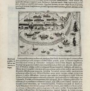
[View of the island of Ternate with the town Gamme Lamme]
1614
Indonesia
Two drawings and text from ‘Rerum et urbis Amstelodamensium historia’ by Johannes Pontanus: the port and town of Gamme Lamme on the island of Ternate, with local and European vessels; and a naval battle between Dutch and Portuguese ships.
- [remove]Fishing2
- Crops1
- Plantation/Forestry Area1


