Search

Search Results

Map to illustrate the Siamese question: showing the present limits of French claims, and the additional territory now demanded

event1893

location_onCambodia, Laos, Malaysia, Myanmar, Thailand, Vietnam

Map highlighting areas of eastern Siam (Thailand) claimed by France. Notes describe Siam’s geography, government, population, military and trade (rice, teak, pepper, bullocks, fish, hides, tin, cardamom, tin), including trading partners by tonnage.

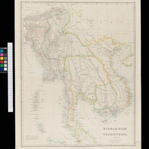
Burmah, Siam and Cochin China

event1875

location_onCambodia, Laos, Malaysia, Myanmar, Thailand, Vietnam

This map of mainland Southeast Asia features short texts noting mines, trade routes and travel times (‘5 to 7 days on Elephants’), history (‘conquered by the King of Siam 1809’), peoples (‘states tributary to the Chinese’) and products (‘Tea Tree’).

A new and accurate map of the East India Islands: laid down according to the latest discoveries, and agreeable to the most approved maps & charts

eventc.1744-1747

location_onBrunei, Cambodia, East Timor, Indonesia, Laos, Malaysia, Myanmar, Philippines, Singapore, Southeast Asia, Thailand, Vietnam

This mid-18th century map of Southeast Asia includes written notes on goods produced and traded, geographical features, and wild animals found in each part of the region.

close

  • Filter from 1744 to 1893

Current results range from 1744 to 1893